-
You are here:
- Homepage » Benin
Benin Country Guide
Explore Benin in Africa
Benin with the capital city Porto-Novo is located in Africa (Western Africa, bordering the Bight of Benin). It covers some 112,620 square kilometres (slightly smaller than Pennsylvania) with 8,294,000 citizens.
The landscape offers mostly flat to undulating plain with some hills and low mountains. The average density of population is approximately 74 per km². The notable climate conditions in Benin can be described as tropical with hot, humid in south and semiarid in north. Potential threats by nature are hot, dry, dusty harmattan wind may affect north from December to March.
To reach someone in Benin dial +229 prior to a number. There are 127,100 installed telephones. And there are 5,033,000 registered mobile phones. The cellular networks commonly support frequencies of 900/1800 MHz. Websites registered in this country end with the top level domain ".bj". If you want to bring electric equipment on your trip (e.g. laptop power supply), note the local power outlet of 220V - 50Hz.
About the flag and history of Benin
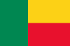
Two equal horizontal bands of yellow (top) and red (bottom) with a vertical green band on the hoist side; green symbolizes hope and revival, yellow wealth, and red courage note: uses the popular Pan-African colors of Ethiopia.
Present day Benin was the site of Dahomey, a West African kingdom that rose to prominence in about 1600 and over the next two and half centuries became a regional power, largely based on its slave trade. Coastal areas of Dahomey began to be controlled by the French in the second half of the 19th century; the entire kingdom was conquered by 1894. French Dahomey achieved independence in 1960; it changed its name to the Republic of Benin in 1975. A succession of military governments ended in 1972 with the rise to power of Mathieu KEREKOU and the establishment of a government based on Marxist-Leninist principles. A move to representative government began in 1989. Two years later, free elections ushered in former Prime Minister Nicephore SOGLO as president, marking the first successful transfer of power in Africa from a dictatorship to a democracy. KEREKOU was returned to power by elections held in 1996 and 2001, though some irregularities were alleged. KEREKOU stepped down at the end of his second term in 2006 and was succeeded by Thomas YAYI Boni, a political outsider and independent. YAYI, who won a second five-year term in March 2011, has attempted to stem corruption and has strongly promoted accelerating Benin's economic growth.
Geography Quick-Facts
| Summary | Continent: Africa Neighbours: Niger, Togo, Burkina Faso, Nigeria Capital: Porto-Novo |
| Size | 112,620 square kilometers (km² or sqkm) or 43,482 square miles (mi² or sqmi) slightly smaller than Pennsylvania |
| Population | 8,294,000 |
| Currency | Name Franc, Currency Code:XOF |
| Country Top Level Domain (cTLD) | .bj |
| Telephone Country Prefix | +229 |
| Mobile Phone Connections | 5,033,000 |
| Landline Phone Connections | 127,100 |
Country Position in World Rankings
Information about single country attributes and how these compare against the rest of the world. The information below is compiled with data from 2013. As such, it may differ a bit to the Information above in the text (which is from 2010).
Geography
| Value name | Value | World Rank |
|---|---|---|
| Area | 112,622 (sq km) | 102 |
People and Society
| Value name | Value | World Rank |
|---|---|---|
| Population | 9,877,292 | 89 |
| Population growth rate | 2.84 (%) | 16 |
| Birth rate | 37.02 (births/1,000 population) | 18 |
| Death rate | 8.59 (deaths/1,000 population) | 77 |
| Maternal mortality rate | 350.00 (deaths/100,000 live births) | 30 |
| Infant mortality rate | 58.54 (deaths/1,000 live births) | 27 |
| Life expectancy at birth | 60.67 (years) | 191 |
| Total fertility rate | 5.13 (children born/woman) | 17 |
| Health expenditures | 4.10 (% of GDP) | 166 |
| HIV/AIDS - adult prevalence rate | 1.20 (%) | 40 |
| HIV/AIDS - people living with HIV/AIDS | 60,000 | 55 |
| HIV/AIDS - deaths | 2,700 | 48 |
| Obesity - adult prevalence rate | 6.00 (%) | 151 |
| Children under the age of 5 years underweight | 20.20 (%) | 34 |
| Education expenditures | 5.40 (% of GDP) | 58 |
| Unemployment, youth ages 15-24 | 0.80 (%) | 143 |
Economy
| Value name | Value | World Rank |
|---|---|---|
| GDP (purchasing power parity) | 15,840,000,000 | 139 |
| GDP - real growth rate | 3.80 (%) | 90 |
| GDP - per capita (PPP) | 1,700 | 199 |
| Labor force | 3,662,000 | 96 |
| Distribution of family income - Gini index | 36.50 | 83 |
| Investment (gross fixed) | 22.60 (% of GDP) | 67 |
| Taxes and other revenues | 18.90 (% of GDP) | 172 |
| Budget surplus (+) or deficit (-) | -3.80 (% of GDP) | 132 |
| Public debt | 30.20 (% of GDP) | 113 |
| Inflation rate (consumer prices) | 6.50 (%) | 172 |
| Central bank discount rate | 4.25 (%) | 82 |
| Stock of narrow money | 1,836,000,000 | 129 |
| Stock of broad money | 2,950,000,000 | 145 |
| Stock of domestic credit | 1,602,000,000 | 142 |
| Industrial production growth rate | 3.00 (%) | 93 |
| Current account balance | -625,300,000 | 101 |
| Exports | 1,578,000,000 | 148 |
| Imports | 2,136,000,000 | 162 |
| Reserves of foreign exchange and gold | 977,000,000 | 139 |
| Debt - external | 953,500,000 | 159 |
Energy
| Value name | Value | World Rank |
|---|---|---|
| Electricity - production | 120,000,000 (kWh) | 193 |
| Electricity - consumption | 778,000,000 (kWh) | 156 |
| Electricity - imports | 866,000,000 (kWh) | 68 |
| Electricity - installed generating capacity | 60,000 (kW) | 177 |
| Electricity - from fossil fuels | 98.30 (% of total installed capacity) | 60 |
| Electricity - from hydroelectric plants | 1.70 (% of total installed capacity) | 139 |
| Crude oil - proved reserves | 8,000,000 (bbl) | 95 |
| Refined petroleum products - consumption | 29,170 (bbl/day) | 118 |
| Refined petroleum products - exports | 11,410 (bbl/day) | 85 |
| Refined petroleum products - imports | 35,140 (bbl/day) | 80 |
| Natural gas - proved reserves | 1,133,000,000 (cu m) | 99 |
| Carbon dioxide emissions from consumption of energy | 3,650,000 (Mt) | 133 |
Communications
| Value name | Value | World Rank |
|---|---|---|
| Telephones - main lines in use | 152,700 | 133 |
| Telephones - mobile cellular | 7,765,000 | 91 |
| Internet hosts | 491 | 183 |
| Internet users | 200,100 | 139 |
Transportation
| Value name | Value | World Rank |
|---|---|---|
| Airports | 5 | 179 |
| Railways | 438 (km) | 113 |
| Roadways | 16,000 (km) | 119 |
| Waterways | 150 (km) | 102 |
Military
| Value name | Value | World Rank |
|---|---|---|
| Military expenditures | 1.50 (% of GDP) | 97 |
Data based on CIA facts book 2010 & 2013, wikipedia, national statistical offices and their census releases
List of current world heritage sites
| Name | Since |
|---|---|
| Royal Palaces of Abomey From 1625 to 1900, 12 kings succeeded one another at the head of the powerful Kingdom of Abomey. With the exception of King Akaba, who had his own separate enclosure, they all had their palaces built within the same cob-wall area, in keeping with pre ... | 1985 |