-
You are here:
- Homepage » Mali
Mali Country Guide
Explore Mali in Africa
The topography includes mostly flat to rolling northern plains covered by sand with savanna in south, rugged hills in northeast. The average density of population is approximately 10 per km². The notable climate conditions in Mali can be described as subtropical to arid with hot and dry (February to June), rainy, humid, and mild (June to November) and cool and dry (November to February). Possible natural disasters include hot, dust-laden harmattan haze common during dry seasons or recurring droughts or occasional Niger River flooding.
To reach someone in Mali dial +223 prior to a number. There are 81,000 installed telephones. And there are 3,742,000 registered mobile phones. The cellular networks commonly support frequencies of 900 MHz. Websites registered in this country end with the top level domain ".ml". If you want to bring electric equipment on your trip (e.g. laptop power supply), note the local power outlet of 220V - 50Hz.
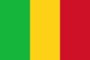
About the flag and history of Mali
Three equal vertical bands of green (hoist side), yellow, and red note: uses the popular Pan-African colors of Ethiopia; the colors from left to right are the same as those of neighboring Senegal (which has an additional green central star) and the reverse of those on the flag of neighboring Guinea.
The Sudanese Republic and Senegal became independent of France in 1960 as the Mali Federation. When Senegal withdrew after only a few months, what formerly made up the Sudanese Republic was renamed Mali. Rule by dictatorship was brought to a close in 1991 by a military coup that ushered in a period of democratic rule. President Alpha KONARE won Mali's first two democratic presidential elections in 1992 and 1997. In keeping with Mali''s two-term constitutional limit, he stepped down in 2002 and was succeeded by Amadou TOURE, who was elected to a second term in 2007 elections that were widely judged to be free and fair. Malian returnees from Libya in 2011 exacerbated tensions in northern Mali, and Tuareg ethnic militias started a rebellion in January 2012. Low- and mid-level soldiers, frustrated with the poor handling of the rebellion overthrew TOURE on 22 March. Intensive mediation efforts led by the Economic Community of West African States (ECOWAS) returned power to a civilian administration in April with the appointment of interim President Dioncounda TRAORE. The post-coup chaos led to rebels expelling the Malian military from the three northern regions of the country and allowed Islamic militants to set up strongholds. Hundreds of thousands of northern Malians fled the violence to southern Mali and neighboring countries, exacerbating regional food insecurity in host communities. A military intervention to retake the three northern regions began in January 2013 and within a month most of the north had been retaken. Democratic elections are scheduled for mid-2013.
Geography Quick-Facts
| Summary | Continent: Africa Neighbours: Senegal, Niger, Algeria, Ivory Coast, Guinea, Mauritania, Burkina Faso Capital: Bamako |
| Size | 1,240,000 square kilometers (km² or sqkm) or 478,766 square miles (mi² or sqmi) slightly less than twice the size of Texas |
| Population | 12,324,000 |
| Currency | Name Franc, Currency Code:XOF |
| Country Top Level Domain (cTLD) | .ml |
| Telephone Country Prefix | +223 |
| Mobile Phone Connections | 3,742,000 |
| Landline Phone Connections | 81,000 |
Country Position in World Rankings
Information about single country attributes and how these compare against the rest of the world. The information below is compiled with data from 2013. As such, it may differ a bit to the Information above in the text (which is from 2010).
Geography
| Value name | Value | World Rank |
|---|---|---|
| Area | 1,240,192 (sq km) | 24 |
People and Society
| Value name | Value | World Rank |
|---|---|---|
| Population | 15,968,882 | 66 |
| Population growth rate | 3.01 (%) | 9 |
| Birth rate | 46.06 (births/1,000 population) | 2 |
| Death rate | 13.55 (deaths/1,000 population) | 16 |
| Net migration rate | -2.41 (migrant(s)/1,000 population) | 169 |
| Maternal mortality rate | 540.00 (deaths/100,000 live births) | 16 |
| Infant mortality rate | 106.49 (deaths/1,000 live births) | 2 |
| Life expectancy at birth | 54.55 (years) | 204 |
| Total fertility rate | 6.25 (children born/woman) | 2 |
| Health expenditures | 5.00 (% of GDP) | 141 |
| HIV/AIDS - adult prevalence rate | 1.00 (%) | 47 |
| HIV/AIDS - people living with HIV/AIDS | 76,000 | 47 |
| HIV/AIDS - deaths | 4,400 | 41 |
| Obesity - adult prevalence rate | 4.30 (%) | 166 |
| Children under the age of 5 years underweight | 27.90 (%) | 22 |
| Education expenditures | 4.80 (% of GDP) | 82 |
Economy
| Value name | Value | World Rank |
|---|---|---|
| GDP (purchasing power parity) | 18,280,000,000 | 136 |
| GDP - real growth rate | -1.20 (%) | 201 |
| GDP - per capita (PPP) | 1,100 | 214 |
| Labor force | 3,241,000 | 101 |
| Unemployment rate | 30.00 (%) | 181 |
| Distribution of family income - Gini index | 40.10 | 59 |
| Taxes and other revenues | 13.50 (% of GDP) | 199 |
| Budget surplus (+) or deficit (-) | -6.90 (% of GDP) | 187 |
| Public debt | 23.20 (% of GDP) | 124 |
| Inflation rate (consumer prices) | 6.50 (%) | 170 |
| Central bank discount rate | 4.25 (%) | 90 |
| Commercial bank prime lending rate | 9.00 (%) | 102 |
| Stock of narrow money | 2,382,000,000 | 122 |
| Stock of broad money | 3,401,000,000 | 141 |
| Stock of domestic credit | 1,938,000,000 | 139 |
| Current account balance | -1,421,000,000 | 123 |
| Exports | 2,557,000,000 | 137 |
| Imports | 3,209,000,000 | 146 |
| Debt - external | 2,725,000,000 | 136 |
| Stock of direct foreign investment - at home | 2,556,000,000 | 91 |
| Stock of direct foreign investment - abroad | 77,440,000 | 86 |
Energy
| Value name | Value | World Rank |
|---|---|---|
| Electricity - production | 520,000,000 (kWh) | 161 |
| Electricity - consumption | 483,600,000 (kWh) | 169 |
| Electricity - installed generating capacity | 304,000 (kW) | 149 |
| Electricity - from fossil fuels | 48.40 (% of total installed capacity) | 159 |
| Electricity - from hydroelectric plants | 51.60 (% of total installed capacity) | 40 |
| Refined petroleum products - consumption | 4,994 (bbl/day) | 170 |
| Refined petroleum products - imports | 4,568 (bbl/day) | 160 |
| Carbon dioxide emissions from consumption of energy | 893,700 (Mt) | 169 |
Communications
| Value name | Value | World Rank |
|---|---|---|
| Telephones - main lines in use | 104,700 | 145 |
| Telephones - mobile cellular | 10,822,000 | 70 |
| Internet hosts | 437 | 187 |
| Internet users | 249,800 | 135 |
Transportation
| Value name | Value | World Rank |
|---|---|---|
| Airports | 21 | 135 |
| Railways | 593 (km) | 109 |
| Roadways | 18,912 (km) | 113 |
| Waterways | 1,800 (km) | 44 |
Military
| Value name | Value | World Rank |
|---|---|---|
| Military expenditures | 1.30 (% of GDP) | 113 |
Data based on CIA facts book 2010 & 2013, wikipedia, national statistical offices and their census releases
List of current world heritage sites
| Name | Since |
|---|---|
| Cliff of Bandiagara (Land of the Dogons) The Bandiagara site is an outstanding landscape of cliffs and sandy plateaux with some beautiful architecture (houses, granaries, altars, sanctuaries and Togu Na, or communal meeting-places). Several age-old social traditions live on in the region (m ... | 1989 |
| Old Towns of Djenné Inhabited since 250 B.C., Djenné became a market centre and an important link in the trans-Saharan gold trade. In the 15th and 16th centuries, it was one of the centres for the propagation of Islam. Its traditional houses, of which nearly 2,000 have ... | 1988 |
| Timbuktu Home of the prestigious Koranic Sankore University and other madrasas, Timbuktu was an intellectual and spiritual capital and a centre for the propagation of Islam throughout Africa in the 15th and 16th centuries. Its three great mosques, Djingareybe ... | 1988 |
| Tomb of Askia The dramatic 17-m pyramidal structure of the Tomb of Askia was built by Askia Mohamed, the Emperor of Songhai, in 1495 in his capital Gao. It bears testimony to the power and riches of the empire that flourished in the 15th and 16th centuries through ... | 2004 |