-
You are here:
- Homepage »
- Cape Verde »
- Porto Novo » Porto Novo

Porto Novo Destination Guide
Explore Porto Novo in Cape Verde
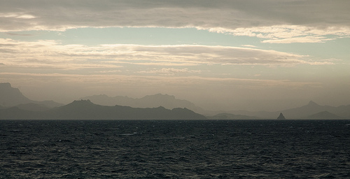
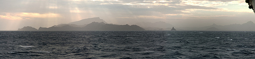
Porto Novo in the region of Porto Novo with its 5,580 inhabitants is a town in Cape Verde - some 177 mi or ( 285 km ) North-West of Praia , the country's capital city .
Current time in Porto Novo is now 02:19 PM (Tuesday) . The local timezone is named " Atlantic/Cape Verde " with a UTC offset of -1 hours. Depending on the availability of means of transportation, these more prominent locations might be interesting for you: Vila do Maio, Vila da Ribeira Brava, Urzeleiro, Tarrafal de Sao Nicolau, and Tarrafal. Since you are here already, make sure to check out Vila do Maio . We saw some video on the web . Scroll down to see the most favourite one or select the video collection in the navigation. Where to go and what to see in Porto Novo ? We have collected some references on our attractions page.
Videos
CHECOMOLA - Cabo Verde
MÁS VÍDEOS ÁFRICA: www.checomola.com CABO VERDE - ISLA DE SAN VICENTE - MINDELO ..
CAP VERT - CABO VERDE
VALLEE DE PAUL- ST ANTAO ..
CVGF 20 06 09
Test trip Fishing Vessel "Julie" Filmed with Canon Ixus 110 compact digital camera ..
Kapverden Bike Adventure Freeride
Freeride auf Kapverden! Der neuste Geheimtipp von bike adventure tours führt uns zu einem unbekannten Inselarchipel zwischen Afrika und Brasilien. Die spannendste Freeride-Insel Santo Antão, die steil ..
Videos provided by Youtube are under the copyright of their owners.
Interesting facts about this location
Porto Novo, Cape Verde (municipality)
Porto Novo (Portuguese for “new port”) is the westernmost municipality in Cape Verde and all of Africa but not the mainland. It is a town and a municipality in the island of Santo Antão of Barlavento. It covers two-thirds of the island and is home to one-third of the population. Geographical features include Topo de Coroa, the tallest mountain of the island, elevating around 1,979 m.
Located at 17.03 -25.07 (Lat./Long.); Less than 2 km away
Paul, Cape Verde
Paul is a municipality in the island of Santo Antão of the Barlavento group in Cape Verde. Together with Ribeira Grande, it covers one-third of the island and home to two-thirds of the population. Farmlands dominate within the Atlantic Coastline and in valley areas especially the central part, grasslands, bushes and forests cover the mountainous parts and the southwestern parts along with dry lands. The taller mountains lie to the southwest.
Located at 17.12 -25.02 (Lat./Long.); Less than 12 km away
Santo Antão, Cape Verde
Santo Antão, or Sontonton in Cape Verdean Creole, is the westernmost and largest of the Barlavento islands of Cape Verde. The nearest main island is São Vicente to the southeast, separated by a channel named Canal de São Vicente. It is the westernmost large island in Cape Verde and the continent of Africa, and the second largest in Cape Verde.
Located at 17.07 -25.17 (Lat./Long.); Less than 13 km away
Janela, Cape Verde
Janela is a village in the northeastern part of the island of Santo Antão. Janela is linked with the road linking to Paul and the rest of the island including the island capital of Porto Novo and Ribeira Grande, the road linking directly through the island's easternmost point is treacherous and is accessed only with 4WD or SUV vehicles as well as bikes.
Located at 17.12 -25.00 (Lat./Long.); Less than 13 km away
Ilhéu dos Pássaros
Ilhéu de Pássaros is an islet located between 2 to 3 kilometres NW of the island of São Vicente and also 2 kilometres northwest of the Mindelo's nearby point, the João Ribeira. They are administratively a part of the municipality of São Vicente. The islet is a volcanic seamount.
Located at 16.91 -25.01 (Lat./Long.); Less than 13 km away
Pictures
Related Locations
Information of geographic nature is based on public data provided by geonames.org, CIA world facts book, Unesco, DBpedia and wikipedia. Weather is based on NOAA GFS.