-
You are here:
- Homepage »
- Australia »
- New South Wales » Guyra

Guyra Destination Guide
Touring Guyra in Australia
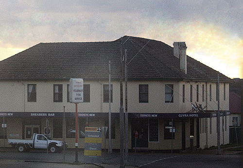
Guyra in the region of New South Wales with its 1,990 citizens is a city located in Australia - some 380 mi or ( 612 km ) North of Canberra , the country's capital city .
Time in Guyra is now 04:31 PM (Wednesday) . The local timezone is named " Australia/Sydney " with a UTC offset of 11 hours. Depending on your travel resources, these more prominent places might be interesting for you: Tubbamurra, Sydney City, Paddledock, Ollera, and Llangothlin. Being here already, consider visiting Tubbamurra . We collected some hobby film on the internet . Scroll down to see the most favourite one or select the video collection in the navigation. Check out our recommendations for Guyra ? We have collected some references on our attractions page.
Videos
New South Wales - von Byron Bay bis Sydney Johannesjudith's photos around New South Wales
Preview of Johannesjudith's blog at TravelPod. Read the full blog here: www.travelpod.com This blog preview was made by TravelPod using the TripAdvisor™ TripWow slideshow creator. Learn more about the ..
Videos provided by Youtube are under the copyright of their owners.
Interesting facts about this location
Guyra, New South Wales
Guyra is a town situated midway between Armidale and Glen Innes on the Northern Tablelands in the New England region of New South Wales, Australia. It is the seat of Guyra Shire. At the 2011 census, Guyra had a population of 1,947. The New England Highway is the main transport link to Guyra. The Northern Railway tracks still pass through the town, but this line is now disused north of Armidale.
Located at -30.20 151.67 (Lat./Long.); Less than 2 km away
Guyra Shire
Guyra Shire is the name of the local government area for the New England region of New South Wales, Australia. It is on the New England Highway.
Located at -30.20 151.67 (Lat./Long.); Less than 2 km away
Llangothlin, New South Wales
Llangothlin is a rural locality with several houses, 11 kilometres north of Guyra on the Northern Tablelands in the New England region of New South Wales, Australia. Llangothlin is located in the Guyra Shire local government area. In 1848 William Rawson was lessee of the 50,000-acre Llangothlin run. Llangothlin was named after its Welsh counterpart in Denbighshire.
Located at -30.13 151.68 (Lat./Long.); Less than 9 km away
Black Mountain, New South Wales
Black Mountain, a village situated between Armidale and Guyra, is located on the Northern Tablelands in the New England region of New South Wales, Australia. Situated within Guyra Shire, as at the 2006 census, Black Mountain had a population of 387.
Located at -30.31 151.66 (Lat./Long.); Less than 10 km away
Mount Duval (New South Wales)
Mount Duval (elevation 1393 m) is a large forested mountain 15 km north of Armidale, New South Wales. The mountain is one of the largest in the area, and is a dominating feature of the Armidale skyline. The mountain was named after John Duval, a convict and servant of a local pastoralist who worked in the area around the mountain in the 1830s. Most of the mountain is contained within the Duval Nature Reserve.
Located at -30.41 151.64 (Lat./Long.); Less than 21 km away
Pictures
Historical Weather
Related Locations
Information of geographic nature is based on public data provided by geonames.org, CIA world facts book, Unesco, DBpedia and wikipedia. Weather is based on NOAA GFS.