-
You are here:
- Homepage »
- Australia »
- New South Wales » Montefiores

Montefiores Destination Guide
Discover Montefiores in Australia
Montefiores in the region of New South Wales with its 541 habitants is a place located in Australia - some 190 mi or ( 306 km ) North of Canberra , the country's capital .
Local time in Montefiores is now 11:19 AM (Saturday) . The local timezone is named " Australia/Sydney " with a UTC offset of 11 hours. Depending on your mobility, these larger cities might be interesting for you: Wuuluman, Sydney City, Suntop, Newrea, and Lincoln. When in this area, you might want to check out Wuuluman . We discovered some clip posted online . Scroll down to see the most favourite one or select the video collection in the navigation. Are you looking for some initial hints on what might be interesting in Montefiores ? We have collected some references on our attractions page.
Videos
Wellington New South Wales Australia A Drive Through
A drive through Wellington from one end to the other. Give my Channel a view to see my other videos ..
Wellington Gateway Sculpture
A look behind the Wellington Gateway, a remarkable environmental sculpture created by project artist Frances (Fran) Ferguson and located on the Mitchell Highway near Wellington, New South Wales, Austr ..
Wellington NSW Ozzybells's photos around Wellington, Australia (blue mountains aboriginal 2010)
Preview of Ozzybells's blog at TravelPod. Read the full blog here: www.travelpod.com This blog preview was made by TravelPod using the TripAdvisor™ TripWow slideshow creator. Learn more about these vi ..
Videos provided by Youtube are under the copyright of their owners.
Interesting facts about this location
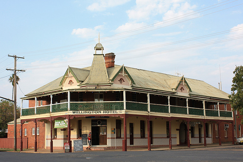
Wellington, New South Wales
Wellington is a town in inland New South Wales, Australia located at the junction of the Macquarie and Bell Rivers. The town is the administrative centre of the Wellington Shire local government area. The town is 362 kilometres from Sydney on the Great Western Highway and Mitchell Highway. In January the average minimum temperature in the town is 17.5 °C and the average maximum is 31.7 °C, while in July the average minimum is 1.5 °C and the average maximum is 15 °C.
Located at -32.55 148.93 (Lat./Long.); Less than 2 km away
Wellington Council (New South Wales)
Wellington Council is a local government area in the Orana region of New South Wales, Australia. The area is located adjacent to the Macquarie River and the Mitchell Highway. Wellington Council area includes Wellington, Maryvale, Geurie, North Yeoval, Dripstone, Mumbil, Stuart Town and Euchareena. The Mayor of Wellington Council is Rod Buhr
Located at -32.55 148.93 (Lat./Long.); Less than 2 km away
Bell River (New South Wales)
Bell River, a watercourse that is part of the Macquarie catchment within the Murray–Darling basin, is located in the central west region of New South Wales, Australia.
Located at -32.55 148.95 (Lat./Long.); Less than 2 km away
Wellington Caves
The Wellington Caves are a group of limestone caves located 8 kilometres south of Wellington, New South Wales, Australia.
Located at -32.62 148.94 (Lat./Long.); Less than 10 km away
Geurie, New South Wales
Geurie is a small village in central-west New South Wales, Australia in Wellington Council. It is located midway between Wellington and Dubbo in the Orana Region of the State. It is located on the Main Western railway line, and is served by the daily Countrylink XPT service between Sydney and Dubbo. At the 2006 census, Geurie had a population of 466. It was the scene of a notable transport accident in 1963.
Located at -32.40 148.83 (Lat./Long.); Less than 18 km away
Pictures
Historical Weather
Related Locations
Information of geographic nature is based on public data provided by geonames.org, CIA world facts book, Unesco, DBpedia and wikipedia. Weather is based on NOAA GFS.