
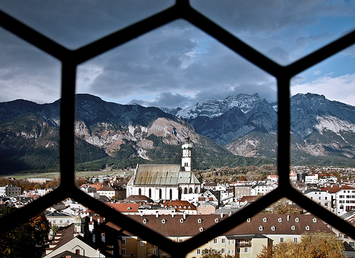
Delve into Mutters in Austria
Mutters in the region of Tyrol with its 1,987 residents is a city in Austria - some 241 mi or ( 389 km ) West of Vienna , the country's capital .
Current time in Mutters is now 12:45 AM (Tuesday) . The local timezone is named " Europe/Vienna " with a UTC offset of 1 hours. Depending on your travel modalities, these larger destinations might be interesting for you: Zirl, Telfes im Stubai, Hall in Tirol, Schoenberg im Stubaital, and Riedbach. While being here, make sure to check out Zirl . We encountered some video on the web . Scroll down to see the most favourite one or select the video collection in the navigation. Are you curious about the possible sightseeing spots and facts in Mutters ? We have collected some references on our attractions page.
Videos
Innsbruck's preparing for summer (Innsbruck's Summer Film)
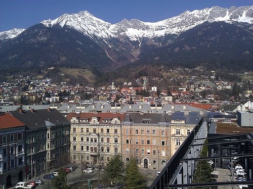
One of the most beautiful places is waiting for you with its stunning panorama, lots of mountains to climb, amazing tracks to walk and bike and lakes and rivers to enjoy the refreshment of the Tyrolea ..
Nutbush City Limits - Solide Alm live
Silvester Innsbruck 06/07 - Solide Alm live mit special guest Tina Turner ..
Europe Driving Montage
Driving in Europe, January 2009. Between the Autobahns in Germany and the twisty alpine passes in northern Italy, there was some fantastic stuff. There was a lot of sightseeing and snowboarding stuff ..
Black Sand I want you
The true colours of the Rockband Black Sand Live ..
Videos provided by Youtube are under the copyright of their owners.
Interesting facts about this location
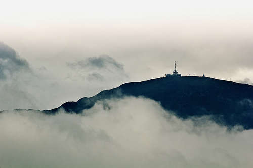
Bergisel
The Bergisel is a hill (746 m) that lies to the south of Innsbruck, Austria, in the area of Wilten, where the Sill river meets the Inn Valley. The word's first syllable Berg- doesn't correspond etymologically to the German word Berg with the meaning mountain. The Bergisel's contemporary name is derived from the pre-Roman word burgusinus (elevated position), which then altered through folk etymology, causing the occasional spelling Berg Isel or its English equivalent Mount Isel.
Located at 47.25 11.40 (Lat./Long.); Less than 2 km away
Bergiselschanze
Bergiselschanze is a ski jumping hill located in Bergisel in Innsbruck, Austria. It is one of the more important venues in the FIS Ski Jumping World Cup, annually hosting the third competition of the prestigious Four Hills Tournament. Its first competitions were held in the 1920s using simple wood constructions. The larger hill was first built in 1930 and was rebuilt before the 1964 Winter Olympics for the individual large hill event. Twelve years later, the venue hosted the same event.
Located at 47.25 11.40 (Lat./Long.); Less than 2 km away
Ruetz
The Ruetz River flows from the glacier area of the valley to the Wipptal in north-east direction. Near the famous "Europe bridge" it merges with the Sill River after a route length of appr. 25 km. The river crosses straight the village of Fulpmes providing a nearby power station of the Austrian Railway Services with electricity. As a typical rapid-river the Ruetz is pretty dangerous and full of rapids. Before several defence structures had been constructed, it was quite feared due to floods.
Located at 47.22 11.40 (Lat./Long.); Less than 2 km away
Lake Lans
The Lake Lans or Lanser See is a lake for bathing near Lans located on the southern highlands above Innsbruck. The lake can be reached by Streetcar Line 6 from Innsbruck easily. The Lake is very popular due to its green environment, and it is used for ice-skating during the winter. The Lake belongs to the city area of Innsbruck. Thanks to its fen water the Lanser See has an excellent water quality; in Summer it is affected due to the many guests though.
Located at 47.24 11.42 (Lat./Long.); Less than 3 km away
Lanser Moor
The Fen of Lans also: Lanser Moor or Water Lily Pond is located north above Lake Lans on an altitude of 582 metres in the Paschberg forest. With an area size of 8000 m² the Lake is much smaller than its larger brother is with a depth of 3 metres. To keep his natural beauty intact, bathing and swimming was already forbidden by the city administration of Innsbruck very early. The Lake is under nature conservation.
Located at 47.24 11.42 (Lat./Long.); Less than 3 km away
Pictures


Historical Weather
Related Locations
Information of geographic nature is based on public data provided by geonames.org, CIA world facts book, Unesco, DBpedia and wikipedia. Weather is based on NOAA GFS.