Discover Saint-Vincent-de-Tyrosse in France
Saint-Vincent-de-Tyrosse in the region of Aquitaine with its 5,898 habitants is a town located in France - some 399 mi or ( 642 km ) South-West of Paris , the country's capital .
Local time in Saint-Vincent-de-Tyrosse is now 03:00 AM (Monday) . The local timezone is named " Europe/Paris " with a UTC offset of 1 hours. Depending on your flexibility, these larger cities might be interesting for you: Vieux-Boucau-les-Bains, Tarnos, Soustons, Soorts-Hossegor, and Saint-Martin-de-Seignanx. When in this area, you might want to check out Vieux-Boucau-les-Bains . We found some clip posted online . Scroll down to see the most favourite one or select the video collection in the navigation. Are you looking for some initial hints on what might be interesting in Saint-Vincent-de-Tyrosse ? We have collected some references on our attractions page.
Videos
PERFECT HOLIDAY
Video-Click "Perfect Holiday" by Karim Rejeb from new SMILE EP 2012 "Seasides: 5 songs 5 videos" more Smile info : www.facebook.com more Karim info: karimrejeb-surfart.com more Smile music open.spotif ..
Home Sweet Spot - Surf à la Gravière, Hossegor, France
Surf à la gravière, mai 2012. Musique de Malik£lectriC. Réalisation Comm'On Prod. Rejoignez-nous sur www.facebook.com www.commonprod.com Merci à nos diffuseurs : Wapala TV - wapalatv.fr Ocean Surf Rep ..
Brunotti Beachcamp in Vieux Boucau - Surfvakantie van Mambo Reizen
Met www.mambo.nl op surfvakantie! Altijd al eens een keer willen surfen op de mooiste golven van de Atlantische Oceaan? Dan is het Brunotti Beachcamp jouw ultieme surfvakantie! Geniet van zon, strand, ..
Camping Les Oyats à Seignosse Saison 2012
Nouvel Espace aquatique, nouveaux hébergements!!!!!!!!!!!!!!! Nouvelle vidéo ..
Videos provided by Youtube are under the copyright of their owners.
Interesting facts about this location
Boudigau
The Boudigau is a coastal river of the Landes, in Aquitaine, Southwest France. It collects waters of the Orx marsh, in Maremne, and flows north behind the dunes fronting the Atlantic Ocean. It flows into the sea, between Capbreton and Hossegor, through the old estuary of the Adour, an estuary which is shared by another coastal river, the Bourret. Owing to this estuary, Capbreton is the only port between Bayonne and Arcachon. Formerly a fishing port, Capbreton is today more of a resort.
Located at 43.65 -1.45 (Lat./Long.); Less than 11 km away
Luy
The Luy, is a left tributary of the Adour, in the Landes, in the Southwest of France.
Located at 43.66 -1.14 (Lat./Long.); Less than 14 km away
Bec du Gave
Bec du Gave, or Bec-des-Gaves, is the point at which the Gavis Réunis stream meets the Adour River in France. The Chateau du Bec du Gavehttp://translate. google. com/translate?hl=en&sl=fr&u=http://www. port-de-lanne. fr/chateau. html&ei=6rirS9LCHsX7lwfx8-m0Dg&sa=X&oi=translate&ct=result&resnum=3&ved=0CBAQ7gEwAg&prev=/search%3Fq%3DCh%25C3%25A2teau%2Bdu%2BBec%2Bdu%2BGave%26hl%3Den is located nearby. Nearest village is Port-de-Lanne.
Located at 43.55 -1.19 (Lat./Long.); Less than 16 km away
Gaves réunis
The Gaves réunis is a 9.4 km river in southwestern France connecting Peyrehorade to the Adour at Bec du Gave. It is formed by the confluence of the Gave de Pau and the Gave d'Oloron.
Located at 43.55 -1.19 (Lat./Long.); Less than 16 km away
Gave de Pau
The Gave de Pau is a river of south-western France and a left tributary of the Adour. It takes its name from the city Pau, through which it flows. The river is 180 kilometres in length, and its source is at the Cirque de Gavarnie in the Pyrenees mountains. The Gave de Pau receives its main tributary, the Gave d'Oloron in Peyrehorade. The 10 km stretch between the mouth of the Gave d'Oloron and the confluence with the Adour is called Gaves Réunis (united Gaves).
Located at 43.55 -1.19 (Lat./Long.); Less than 16 km away
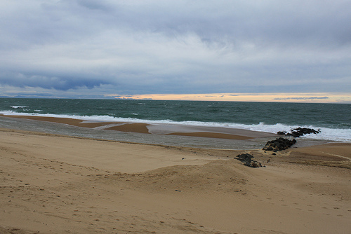
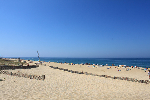
Pictures


Related Locations
 Saint-Vincent-le-Paluel (Aquitaine)
- Saint-Vincent-la-Commanderie (Rhône-Alpes)
- Saint-Vincent-la-Chatre (Poitou-Charentes)
- Saint-Vincent-Jalmoutiers (Aquitaine)
- Saint-Vincent-en-Bresse (Bourgogne)
- Saint-Vincent-du-Pendit (Midi-Pyrénées)
- Saint-Vincent-du-Lorouer (Pays de la Loire)
- Saint-Vincent-du-Boulay (Haute-Normandie)
- Saint-Vincent-des-Pres (Pays de la Loire)
- Saint-Vincent-des-Pres (Bourgogne)
- Saint-Vincent-des-Landes (Pays de la Loire)
- Saint-Vincent-des-Bois (Haute-Normandie)
- Saint-Vincent-de-Reins (Rhône-Alpes)
- Saint-Vincent-de-Pertignas (Aquitaine)
- Saint-Vincent-de-Paul (Aquitaine)
- Saint-Vincent-de-Mercuze (Rhône-Alpes)
Information of geographic nature is based on public data provided by geonames.org, CIA world facts book, Unesco, DBpedia and wikipedia. Weather is based on NOAA GFS.