-
You are here:
- Homepage »
- France »
- Basse-Normandie » Bavent

Bavent Destination Guide
Touring Bavent in France
Bavent in the region of Basse-Normandie with its 1,795 citizens is a city located in France - some 118 mi or ( 189 km ) West of Paris , the country's capital city .
Time in Bavent is now 09:05 AM (Monday) . The local timezone is named " Europe/Paris " with a UTC offset of 1 hours. Depending on your travel resources, these more prominent places might be interesting for you: London, Cambridge, Bristol, Birmingham, and Robehomme. Being here already, consider visiting London . We collected some hobby film on the internet . Scroll down to see the most favourite one or select the video collection in the navigation. Check out our recommendations for Bavent ? We have collected some references on our attractions page.
Videos
Brittany Ferries Normandie
Normandie's video at Ouistreham harbour in august 2009 // Visit : www.passsengerships.fr ..
Brittany Ferries Normandie
Normandie Ouistreham in august 2008 // Visit : www.passsengerships.fr ..
Ville de Cabourg - La thalassothérapie - épisode 3.m4v
Retrouvez le troisième reportage sur le chantier de la thalassothérapie de la Ville de Cabourg. Tourné en mars dernier avec Monsieur le Maire de Cabourg, le Docteur Jean-Paul Henriet, Hervé Caron, Dir ..
BRITTANY FERRIES MV Mont St Michel à Ouistreham.
Appareillage du Mont Saint Michel de Ouistreham. Regarder jusqu'à la fin... Mont Saint Michel leaving Ouistreham. Watch till the end... ..
Videos provided by Youtube are under the copyright of their owners.
Interesting facts about this location
Merville Gun Battery
The Merville Gun Battery was a coastal fortification in Normandy, France, in use as part of the Nazis' Atlantic Wall built to defend continental Europe from Allied invasion. It was a particularly heavily fortified position and one of the first places to be attacked by Allied forces during the Normandy Landings commonly known as D-Day.
Located at 49.27 -0.20 (Lat./Long.); Less than 4 km away
Battle of Merville Gun Battery
The Battle of Merville Gun Battery occurred on 6 June 1944, as part of the Normandy landings. Allied intelligence believed the Merville Gun Battery was composed of heavy-calibre guns that could threaten the British landings at Sword Beach, only 8 miles away. The British 9th Parachute Battalion, part of the 6th Airborne Division, was given the objective of destroying the battery.
Located at 49.27 -0.20 (Lat./Long.); Less than 5 km away
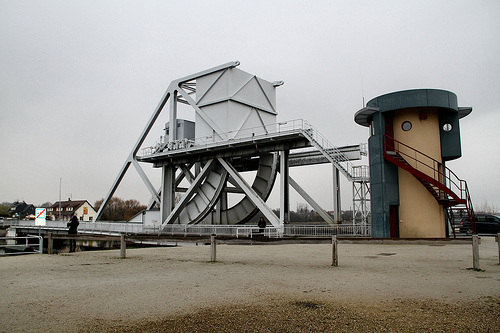
Horsa Bridge
Horsa Bridge, also known as Ranville bridge, over the Orne River, was, with Pegasus Bridge, captured during Operation Deadstick by gliderborne troops of the 2nd Oxfordshire and Buckinghamshire Light Infantry (the 52nd) in a coup de main operation in the opening minutes of D Day, 6 June 1944.
Located at 49.24 -0.27 (Lat./Long.); Less than 6 km away
Orne (river)
The Orne is a river in Normandy, within northwestern France. It discharges into the English Channel at the port of Ouistreham. Its source is in Aunou-sur-Orne, east of Sées. The Odon is one of its tributaries. The Orne flows through the following departments and towns: Orne (named after the river): Sées, Argentan Calvados: Thury-Harcourt, Caen, Ouistreham
Located at 49.28 -0.23 (Lat./Long.); Less than 6 km away
Operation Deadstick
Operation Deadstick was the codename for an airborne forces operation by the British Army that took place on 6 June 1944 as part of the Normandy landings. The mission's objective was to capture intact two road bridges in Normandy across the River Orne and the Caen Canal providing the only exit eastwards for British forces from their landing on Sword Beach. Intelligence reports said both bridges were heavily defended by the Germans and wired for demolition.
Located at 49.24 -0.27 (Lat./Long.); Less than 7 km away
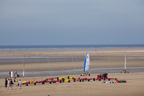
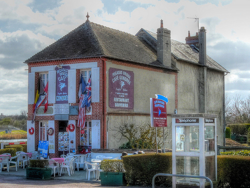
Pictures
Historical Weather
Related Locations
Information of geographic nature is based on public data provided by geonames.org, CIA world facts book, Unesco, DBpedia and wikipedia. Weather is based on NOAA GFS.