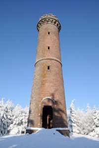
Delve into Dabo in France
Dabo in the region of Lorraine with its 2,875 residents is located in France - some 223 mi or ( 359 km ) East of Paris , the country's capital .
Local time in Dabo is now 08:21 PM (Monday) . The local timezone is named " Europe/Paris " with a UTC offset of 1 hours. Depending on your mobility, these larger destinations might be interesting for you: Basel, The Hague, Haarlem, Amsterdam, and Brussels. While being here, you might want to check out Basel . We discovered some clip posted online . Scroll down to see the most favourite one or select the video collection in the navigation. Are you curious about the possible sightseeing spots and facts in Dabo ? We have collected some references on our attractions page.
Videos
Plan incliné de Saint-Louis Arzviller (Moselle Tourisme)
www.moselle-tourisme.com Petite croisière en famille au fil de l'eau Pour se détendre et voguer en toute originalité, pourquoi ne pas descendre le plan incliné de Saint-Louis Arzviller ? Ascenseur à b ..
Cruise on the canal de la Marne au Rhin - 2009
Mostly photos and some videos from our one week cruise on the Canal de la Marne au Rhin in the Alsace-Lorraine area in late June - early July 2009. The route was from Hesse to Strasbourg and back, pas ..
Eco Friendly holiday resort development from Center Parcs in the Moselle
This is the 4th holiday resort created by Center Parcs in France. There will be more than 870 cottages for short breaks. The project is worth more than 300 millions euros. ..
The Canals of France, Saverne France
Saverne is on the Rhine-Marne Canal at the foot of the Vosges and outside Strasbourg. The emblem of the town is a unicorn. Legend has it that a unicorn's horn was found in one of the nearby castles in ..
Videos provided by Youtube are under the copyright of their owners.
Interesting facts about this location
Château de Wangenbourg
The Château de Wangenbourg is a ruined castle in the commune of Wangenbourg-Engenthal in the Bas-Rhin département of France.
Located at 48.62 7.31 (Lat./Long.); Less than 7 km away
Saint-Louis-Arzviller inclined plane
The Saint-Louis-Arzviller inclined plane is part of the Marne-Rhine Canal (French: Canal de la Marne au Rhin), located in the commune of Saint-Louis, between the towns of Saint-Louis and Arzviller in the département of the Moselle. It enables the canal to cross the Vosges Mountains.
Located at 48.72 7.22 (Lat./Long.); Less than 7 km away
Château du Freudeneck
Château du Freudeneck is a ruined medieval castle situated in the commune of Wangenbourg-Engenthal in the Bas-Rhin département in Alsace, France.
Located at 48.63 7.33 (Lat./Long.); Less than 7 km away
Château du Nideck
The Château du Nideck is a ruined castle located in the commune of Oberhaslach in the Bas-Rhin département of France.
Located at 48.58 7.28 (Lat./Long.); Less than 9 km away
Château du Petit-Geroldseck
The Château du Petit-Geroldseck is a ruined castle situated in the commune of Haegen in the département of Bas-Rhin in Alsace, France. It is dated to the 13th century. It has been listed since 1898 as a monument historique by the French Ministry of Culture.
Located at 48.71 7.33 (Lat./Long.); Less than 10 km away
Pictures
Historical Weather
Related Locations
Information of geographic nature is based on public data provided by geonames.org, CIA world facts book, Unesco, DBpedia and wikipedia. Weather is based on NOAA GFS.


