-
You are here:
- Homepage »
- France »
- Rhone-Alpes » Chazey-sur-Ain

Chazey-sur-Ain Destination Guide
Explore Chazey-sur-Ain in France
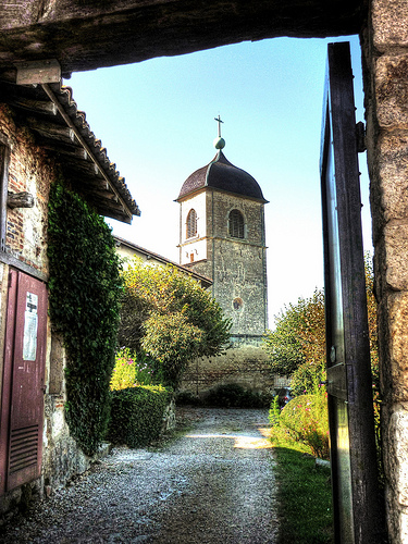
Chazey-sur-Ain in the region of Rhône-Alpes with its 1,305 inhabitants is a place in France - some 246 mi or ( 395 km ) South-East of Paris , the country's capital city .
Time in Chazey-sur-Ain is now 04:27 PM (Tuesday) . The local timezone is named " Europe/Paris " with a UTC offset of 1 hours. Depending on your budget, these more prominent locations might be interesting for you: Geneva, Villieu-Loyes-Mollon, Vaux-en-Bugey, Valence, and Tignieu-Jameyzieu. Since you are here already, consider visiting Geneva . We saw some hobby film on the internet . Scroll down to see the most favourite one or select the video collection in the navigation. Where to go and what to see in Chazey-sur-Ain ? We have collected some references on our attractions page.
Videos
241P17 sous un déluge
Faut aimer le train pour sortir dans ce genre de condition... Mais bon, trop de pluie, ca fait pas briller la loco dommage, l'ambiance est quand même sympa :). Mai 2007 ..
Pérouges
Cité médiévale : Pérouges dans l'Ain vous ouvre ses portes et vous fait découvrir ses fabuleuses demeures moyennageuses. ..
Trip Canada 2007
trip Vtt à Whistler BC, North shore, Kamloops... ..
vacance a meribel
ke de belles tetes !!! ..
Videos provided by Youtube are under the copyright of their owners.
Interesting facts about this location
Canton of Meximieux
The canton of Meximieux is an administrative division in eastern France.
Located at 45.91 5.20 (Lat./Long.); Less than 5 km away
Canton of Lagnieu
The canton of Lagnieu is an administrative division in eastern France. It includes the following communes: Commune Inhabitants Postal code INSEE code Ambutrix 586 1500 01008 Blyes 692 1150 01047 Chazey-sur-Ain 1 200 1150 01099 Lagnieu 5 882 1150 01202 Leyment 922 1150 01213 Loyettes 2 322 1360 01224 Sainte-Julie 535 1150 01366 Saint-Sorlin-en-Bugey 939 1150 01386 Saint-Vulbas 804 1150 01390 Sault-Brénaz 973 1150 01396 Souclin 221 1150 01411 Vaux-en-Bugey 1 003 1150 01431 Villebois 954 1150 01444
Located at 45.90 5.35 (Lat./Long.); Less than 7 km away
Canton of Ambérieu-en-Bugey
The canton of Ambérieu-en-Bugey is an administrative division in eastern France. It includes the following communes: Commune Inhabitants Postal code INSEE code L'Abergement-de-Varey 168 01640 01002 Ambérieu-en-Bugey 11 436 01500 01004 Ambronay 2 146 01500 01007 Bettant 683 01500 01041 Château-Gaillard 1 370 01500 01089 Douvres 646 01500 01149 Saint-Denis-en-Bugey 1 944 01500 01345 Saint-Maurice-de-Rémens 604 01500 01379
Located at 45.96 5.35 (Lat./Long.); Less than 11 km away
Loyettes Airfield
Loyettes Airfield is an abandoned World War II United States Army Air Forces military airfield in France, which was located approximately 1 km north of Loyettes (Département de l'Ain,Rhone-Alpes), 28 km east of Lyon. It was located at a prewar grass airdrome, which was improved by the XII Engineer Command for military aircraft use. It was known as Advanced Landing Ground Y-25. Y-25 consisted of the sod runway, 6000' in length and 150' wide, aligned 02/20.
Located at 45.79 5.21 (Lat./Long.); Less than 12 km away
Veyle
The Veyle is a 66.9 km long river in the Ain département, eastern France. Its source is in Chalamont. It flows generally northwest. It is a left tributary of the Saône into which it flows between Grièges and Crottet, near Mâcon.
Located at 46.00 5.21 (Lat./Long.); Less than 13 km away
Pictures
Historical Weather
Related Locations
Information of geographic nature is based on public data provided by geonames.org, CIA world facts book, Unesco, DBpedia and wikipedia. Weather is based on NOAA GFS.