-
You are here:
- Homepage »
- Germany »
- Rheinland-Pfalz » Rech

Rech Destination Guide
Delve into Rech in Germany
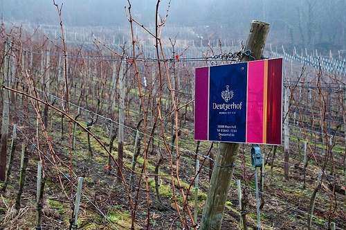
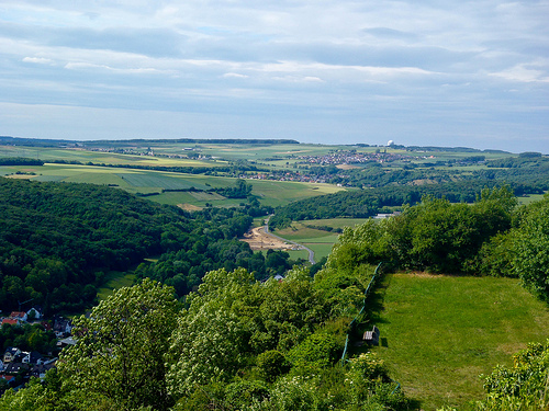
Rech in the region of Rheinland-Pfalz with its 580 residents is a city in Germany - some 307 mi or ( 494 km ) South-West of Berlin , the country's capital .
Current time in Rech is now 04:26 PM (Tuesday) . The local timezone is named " Europe/Berlin " with a UTC offset of 1 hours. Depending on your travel modalities, these larger destinations might be interesting for you: The Hague, Haarlem, Amsterdam, Brussels, and Wiesbaden. While being here, make sure to check out The Hague . We encountered some video on the web . Scroll down to see the most favourite one or select the video collection in the navigation. Are you curious about the possible sightseeing spots and facts in Rech ? We have collected some references on our attractions page.
Videos
Top Secret Regierungs-Bunker Marienthal
bitodi.blogspot.com or http Marienthal,The German Government nuclear bunker,Ausweichsitz der Bundesregierung, Bundesregierung, Ahr, Ahrtal, Wikoch Spionage Spion Kalter Krieg USA Amerika Russland Deut ..
Dernau / Ahr
Weinort Dernau an der Ahr im Sommer 2008 ..
Altenahr
..
Rotweinwanderweg
Herrlich Tage an der Ahr ..
Videos provided by Youtube are under the copyright of their owners.
Interesting facts about this location
Altenahr (Verbandsgemeinde)
Altenahr is a Verbandsgemeinde ("collective municipality") in the district of Ahrweiler, in Rhineland-Palatinate, Germany. The seat of the municipality is in Altenahr. The Verbandsgemeinde Altenahr consists of the following Ortsgemeinden ("local municipalities"): Ahrbrück Altenahr Berg Dernau Heckenbach Hönningen Kalenborn Kesseling Kirchsahr Lind Mayschoß
Located at 50.52 6.99 (Lat./Long.); Less than 3 km away
Government bunker (Germany)
The Government Bunker (Regierungsbunker) in Germany, officially named Ausweichsitz der Verfassungsorgane des Bundes im Krisen- und Verteidigungsfall zur Wahrung von deren Funktionstüchtigkeit (AdVB), in English: "Emergency Seat of the Federal Constitutional Organs for the State of Crisis or State of Defence to Maintain their Ability to Function" was a massive underground complex designed to house the German government, parliament and all federal personnel needed to keep the government working in the event of war or severe crisis.
Located at 50.54 7.06 (Lat./Long.); Less than 3 km away
Ahrweiler
Ahrweiler is a district in the north of Rhineland-Palatinate, Germany. It is bounded by (from the north and clockwise) the districts Euskirchen, Rhein-Sieg and the city Bonn in the state North Rhine-Westphalia, and the districts of Neuwied, Mayen-Koblenz and Vulkaneifel.
Located at 50.53 7.08 (Lat./Long.); Less than 4 km away
Swist
The Swist is a brook in North Rhine-Westphalia and Rhineland-Palatinate, Germany. It rises in Rhineland-Palatinate at the Eifel on 330 m sealevel. The brook is 43,6 km long, and joins the Erft at the mouth in North Rhine-Westphalia. It flows through the municipality Swisttal, the town Meckenheim and Flerzheim, a local part of the town Rheinbach. In this area are many cycle paths at the edge of the brook. The Swist gave its name to the municipality of Swisttal and the town of Weilerswist.
Located at 50.55 6.99 (Lat./Long.); Less than 5 km away
Nette (Rhine)
The Nette is a small river in Rhineland-Palatinate, Germany, a left tributary of the Rhine. It rises in the Eifel, south of Nürburg. The Nette flows east through Mayen before reaching the Rhine between Weißenthurm and Andernach. Nette gives her name to one of the Königsbacher Pils beers.
Located at 50.43 7.09 (Lat./Long.); Less than 10 km away
Pictures
Historical Weather
Related Locations
Information of geographic nature is based on public data provided by geonames.org, CIA world facts book, Unesco, DBpedia and wikipedia. Weather is based on NOAA GFS.