
Explore Rathmannsdorf in Germany
Rathmannsdorf in the region of Saxony with its 1,155 inhabitants is a town in Germany - some 115 mi or ( 184 km ) South of Berlin , the country's capital city .
Current time in Rathmannsdorf is now 01:18 AM (Saturday) . The local timezone is named " Europe/Berlin " with a UTC offset of 1 hours. Depending on the availability of means of transportation, these more prominent locations might be interesting for you: Waitzdorf, Stolpen, Prossen, Plan, and Neustadt in Sachsen. Since you are here already, make sure to check out Waitzdorf . We encountered some video on the web . Scroll down to see the most favourite one or select the video collection in the navigation. Where to go and what to see in Rathmannsdorf ? We have collected some references on our attractions page.
Videos
Sächsische Schweiz Summit - Herbst 2008
Rahmhanke, Riegelhof-Stiege, Sächsische Schweiz, Kletterstiegen, Klettersteig, Wandern, Wandertipps auf www.zwillingsstiege.de ..
Baikalplan - Jahreshauptversammlung 2007
Baikalplans yearly main session 2007 in Struppen, Saxonian Swiss. ..
Speisekammer-Stiege
Stiege zur Speisekammer, Sächsische Schweiz, Kletterstiege, Wandern, Wandertipps mehr auf www.zwillingsstiege.de ..
Rahmhanke
Rahmhanke, Sächsische Schweiz, Kletterstiege, Wandern, Wandertipps mehr auf www.zwillingsstiege.de ..
Videos provided by Youtube are under the copyright of their owners.
Interesting facts about this location
Kleinhennersdorfer Stein
Kleinhennersdorfer Stein is a mountain of Saxony, southeastern Germany.
Located at 50.92 14.13 (Lat./Long.); Less than 2 km away
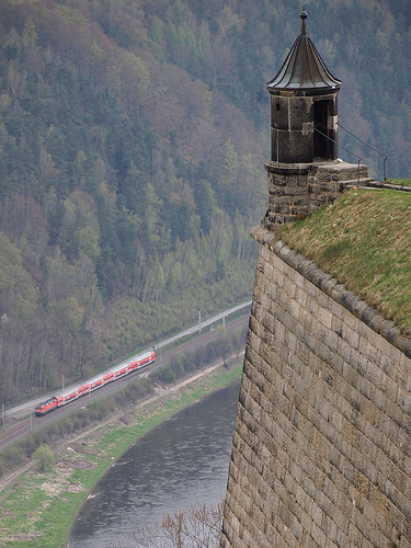
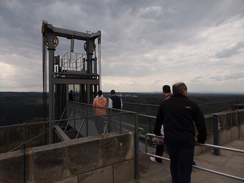
Bad Schandau Elevator
The Bad Schandau elevator is a passenger truss-tower elevator built in 1904 at Bad Schandau, which runs from Bad Schandau on the Ostrau. The height of the elevator is 52.26 m, in art nouveau arranged steel framework tower upward, which has a diameter of 5.20 m at the ground and at the door such of 2.5 metres. On the way upward it overcomes a difference in height of 47.76 m.
Located at 50.92 14.16 (Lat./Long.); Less than 2 km away
Brand (Saxon Switzerland)
Brand (Sächsische Schweiz) is a mountain of Saxony, southeastern Germany.
Located at 50.96 14.13 (Lat./Long.); Less than 3 km away
Papststein
(in exact centre) and the Lilienstein (right). The village has the name Kurort Gohrisch. ]] Papststein is a mountain of Saxony, southeastern Germany.
Located at 50.90 14.12 (Lat./Long.); Less than 3 km away
Saxon Switzerland
Saxon Switzerland is a hilly climbing area and national park around the Elbe valley south-east of Dresden in Saxony, Germany. Together with the Bohemian Switzerland in the Czech Republic it forms the Elbe Sandstone Mountains. Saxon Switzerland alone has some 1,000 climbing peaks, as well as several hollows. The area is popular with Dresden locals and international climbers. The administrative district for the area is Sächsische Schweiz-Osterzgebirge.
Located at 50.93 14.20 (Lat./Long.); Less than 4 km away
Pictures

Historical Weather
Related Locations
Information of geographic nature is based on public data provided by geonames.org, CIA world facts book, Unesco, DBpedia and wikipedia. Weather is based on NOAA GFS.