
Touring Bodh Gaya in India
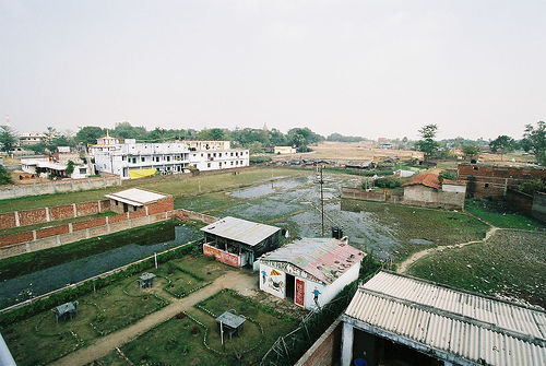
Bodh Gaya in the region of Bihār with its 35,188 citizens is a city located in India - some 551 mi or ( 886 km ) South-East of New Delhi , the country's capital city .
Time in Bodh Gaya is now 08:22 AM (Tuesday) . The local timezone is named " Asia/Kolkata " with a UTC offset of 5.5 hours. Depending on your travel resources, these more prominent places might be interesting for you: Rajshahi, Tankuppa, Ranchi, Raipur, and Patna. Being here already, consider visiting Rajshahi . We collected some hobby film on the internet . Scroll down to see the most favourite one or select the video collection in the navigation. Check out our recommendations for Bodh Gaya ? We have collected some references on our attractions page.
Videos
Buddhist Monks Chanting, Bodh Gaya
Buddhist Monks Chanting, Bodh Gaya, India ..
Full Prostrations in Bodh Gaya
Under the famous Bodhi Tree in Bodh Gaya, India there is a lot going on at peak season. Here you can see the amazing Tibetan trumpeters, a woman bowing directly under the tree, and men and women doing ..
Garab Rinpoche performing Jang Chog @ Bodh Gaya
Dungse Garab Rinpoche performing the Jang Chog- ritual for liberation of the deceased- during the 2010 Dudjom Throemai Tshogbum Chhenmo under the bodhi tree in Bodhgaya in February 2010. This takes pl ..
Bodh Gaya and the Pragya Vihar School, wide screen edition
Here you can see some of the charm of Bodh Gaya and learn about a small inter-religious school that Western Pilgrims sponsor. For more on the school please see thomasriddle.net. ..
Videos provided by Youtube are under the copyright of their owners.
Interesting facts about this location
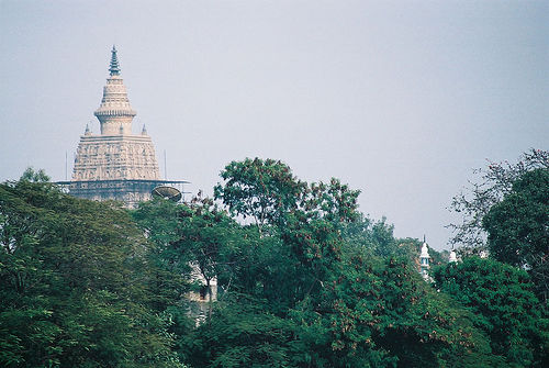
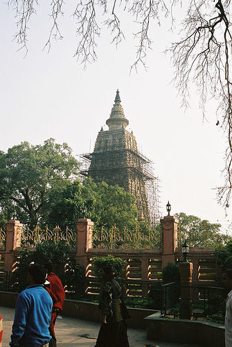
Mahabodhi Temple
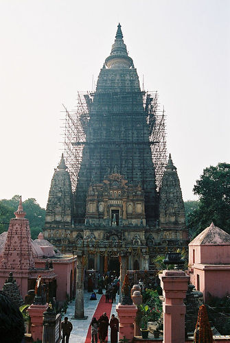
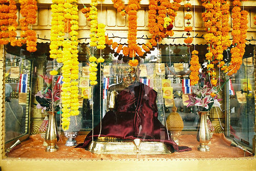
The Mahabodhi Temple (महाबोधि मंदिर) is a Buddhist temple in Bodh Gaya, the location where Siddhartha Gautama, the Buddha, is said to have attained enlightenment. Bodh Gaya is located about 96 km from Patna, Bihar state, India. Next to the temple, to its western side, is the holy Bodhi tree. In the Pali Canon, the site is called Bodhimanda, and the monastery there the Bodhimanda Vihara. The tallest tower is 55 metres tall.
Located at 24.70 84.99 (Lat./Long.); Less than 1 km away
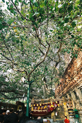
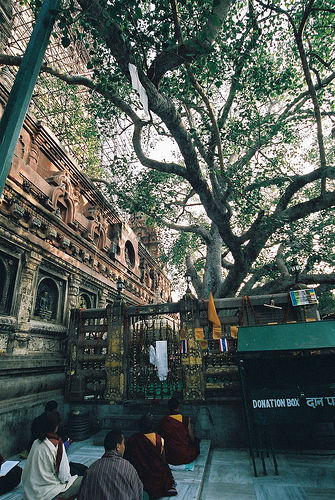
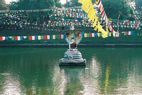
Bodhi Tree
The Bodhi Tree, also known as Bo (from the Sinhalese Bo), was a large and very old Sacred Fig tree (Ficus religiosa) located in Bodh Gaya, under which Siddhartha Gautama, the spiritual teacher later known as Gautama Buddha, is said to have achieved enlightenment, or Bodhi. In religious iconography, the Bodhi tree is recognizable by its heart-shaped leaves, which are usually prominently displayed.
Located at 24.70 84.99 (Lat./Long.); Less than 1 km away
Bodh Gaya
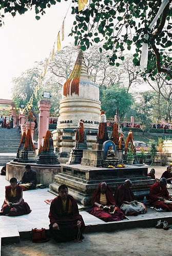
Bodh Gaya is a religious site and place of pilgrimage associated with the Mahabodhi Temple Complex in Gaya district in the Indian state of Bihar. It is famous for being the place where Gautama Buddha is said to have obtained Enlightenment. The place-name, Bodh Gaya, did not come into use until the 18th century CE. Historically, it was known as Uruvela, Sambodhi, Vajrasana or Mahabodhi. The main monastery of Bodh Gaya used to be called the Bodhimanda-vihāra.
Located at 24.70 84.99 (Lat./Long.); Less than 1 km away
Munger division
Munger division is an administrative geographical unit of Bihar state of India. Munger is the administrative headquarters of the division. Currently (2005), the division consists of Munger District, Jamui District, Khagaria District, Lakhisarai District, and Sheikhpura District. Earlier all these districts were part of Munger (earlier known as Monghyr) district.
Located at 24.75 85.00 (Lat./Long.); Less than 6 km away
Nawada district
Nawada district is one of the thirty-eight districts of Bihar state, India, and Nawada town is the administrative headquarters of this district. The district was part of the Magadh, Sunga and Gupta empires. It is located between historical districts of Nalanda and Gaya and falls under Magadha Commissionary.
Located at 24.75 85.00 (Lat./Long.); Less than 6 km away
Pictures
Historical Weather
Related Locations
Information of geographic nature is based on public data provided by geonames.org, CIA world facts book, Unesco, DBpedia and wikipedia. Weather is based on NOAA GFS.