-
You are here:
- Homepage »
- Italy »
- Friuli Venezia Giulia » Camporosso in Valcanale

Camporosso in Valcanale Destination Guide
Explore Camporosso in Valcanale in Italy
Camporosso in Valcanale in the region of Friuli Venezia Giulia is a town in Italy - some 323 mi or ( 520 km ) North of Rome , the country's capital city .
Current time in Camporosso in Valcanale is now 10:55 PM (Thursday) . The local timezone is named " Europe/Rome " with a UTC offset of 1 hours. Depending on the availability of means of transportation, these more prominent locations might be interesting for you: St Stefan im Gailtal, Sankt Paul an der Gail, Sankt Georgen im Gailtal, Klagenfurt, and Arnoldstein. Since you are here already, make sure to check out St Stefan im Gailtal . We encountered some video on the web . Scroll down to see the most favourite one or select the video collection in the navigation. Where to go and what to see in Camporosso in Valcanale ? We have collected some references on our attractions page.
Videos
Mudslide on A23 on 99th km approaching Tarvisio, Italy - 04.09.2009
This mudslide held us for about 1 hour. However the motorway services were very quick to respond. We hit some really bad weather along A23 on that day. ..
Transiti sulla vecchia Pontebbana 2
Seconda parte del filmato che riprende i transiti dei treni sulla vecchia ferrovia Pontebbana prima della sua chiusura. ..
Krampus.. atto di dolore
San Nicolò ei Krampus a Tarvisio 05/12/2009 - San Nicolò porta doni ai bambini buoni ... ei Krampus cercano! ..
Transiti sulla vecchia Pontebbana 11
Undicesima ed ultima parte del filmato che riprende i transiti dei treni sulla vecchia ferrovia Pontebbana prima della sua chiusura. Si osservano alcuni treni dell'ultimo giorno di esercizio ed il pri ..
Videos provided by Youtube are under the copyright of their owners.
Interesting facts about this location
Cave del Predil
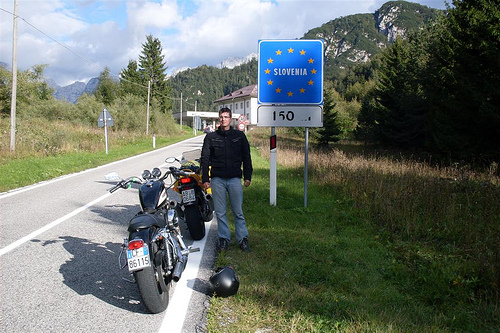
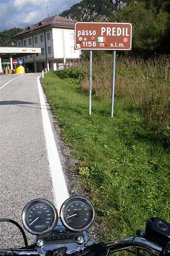
Cave del Predil is a frazione subdivision of the comune of Tarvisio in the Province of Udine, in the Friuli-Venezia Giulia region of northeastern Italy. The hamlet is located about 15 km (9 mi) south of the town centre, in the valley of the Rio del Lago (Seebach) river on the road to the Predil Pass of the western Julian Alps, close to the border with Slovenia.
Located at 46.44 13.57 (Lat./Long.); Less than 8 km away
Burgruine Straßfried
Burgruine Straßfried is a castle in Carinthia, Austria. It is located next to the Austrian-Italian border by Arnoldstein in Carinthia. The name of the castle means Ruins of Castle Strasbourg and draws attention to its location and its earlier strategic importance. Straßfried lies on a forested hill at the junction of roads from Italy with another from the Gail River valley.
Located at 46.55 13.66 (Lat./Long.); Less than 9 km away
Lago del Predil
Lago del Predil is a lake in the Province of Udine, Friuli-Venezia Giulia, Italy near Slovenian border. At an elevation of 969 m, its surface area is 1 km².
Located at 46.42 13.57 (Lat./Long.); Less than 11 km away
Log pod Mangartom Mosque
The Log pod Mangartom Mosque (Slovene: Džamija v Logu pod Mangartom) was a Sunni mosque that stood from 1916 until the 1920s near the village of Log pod Mangartom in Carniola, Austria-Hungary, in the area of the nowadays Municipality of Bovec in northwestern Slovenia. It was the first—and, as of 2009, the only—purpose-built mosque ever established in the territory of Slovenia, though one converted out of a preexisting building has functioned in the town of Jesenice since 1989.
Located at 46.40 13.60 (Lat./Long.); Less than 12 km away
Sendeturm Dobratsch
The Sendeturm Dobratsch (Dobratsch Transmitter Tower) is a 165m/541ft high radio tower on the Dobratsch mountain in Carinthia, Austria, built in 1971. It consists of a concrete tower which carries a guyed steel tube mast on the top, similar to the Gerbrandy Tower in the Netherlands. Dobratsch Transmitter Tower is used for directional radio services and FM broadcasting as well as for DVB-T transmission of several TV programmes. 125,000 watts ERP make it the strongest transmitter of Austria.
Located at 46.60 13.67 (Lat./Long.); Less than 14 km away
Pictures
Historical Weather
Related Locations
Information of geographic nature is based on public data provided by geonames.org, CIA world facts book, Unesco, DBpedia and wikipedia. Weather is based on NOAA GFS.