
Explore Civitella d'Agliano in Italy
Civitella d'Agliano in the region of Latium with its 1,734 inhabitants is a town in Italy - some 51 mi or ( 82 km ) North of Rome , the country's capital city .
Current time in Civitella d'Agliano is now 06:26 AM (Friday) . The local timezone is named " Europe/Rome " with a UTC offset of 1 hours. Depending on the availability of means of transportation, these more prominent locations might be interesting for you: Vaiano, Urbino, Siena, Sermugnano, and Sant'Angelo. Since you are here already, make sure to check out Vaiano . We saw some video on the web . Scroll down to see the most favourite one or select the video collection in the navigation. Where to go and what to see in Civitella d'Agliano ? We have collected some references on our attractions page.
Videos
presepe vivente bagnoregio.mp4
RAI PRESEPE VIVENTE DI BAGNOREGIO ..
200 mph on the Italian Frecciarossa (Alta Velocità) Train
A ride on one of Italy's bullet trains between Florence and Rome ..
Lubriano.wmv
Lubriano un piccolo grande paese ..
Sheep in Celleno, Italy
Sheep in Celleno, Italy ..
Videos provided by Youtube are under the copyright of their owners.
Interesting facts about this location
Castel Cellesi
Castel Cellesi is a tiny Italian village located in the area of Tuscia at the meeting point of Northern Lazio, Umbria and Tuscany. It is a frazione of Bagnoregio, in the Province of Viterbo.
Located at 42.59 12.15 (Lat./Long.); Less than 3 km away
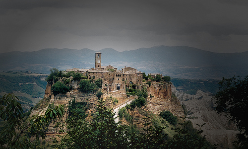
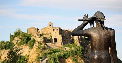
Civita di Bagnoregio
Civita di Bagnoregio is a town in the Province of Viterbo in Central Italy, a frazione of the comune of Bagnoregio, 2 km (about 1 mile) W from it. It is about 145 km north of Rome.
Located at 42.63 12.11 (Lat./Long.); Less than 7 km away
Paglia (river)
The Paglia is an Italian river and a tributary of the Tiber. It rises on the southern slopes of Monte Amiata (1,738 m) on the Plain of Rena near the town of Abbadia San Salvatore. It flows through the provinces of Siena, Viterbo and Terni, and flows into the Tiber to the south-east of Orvieto. It is approximately 86 km long and its flow is highly seasonal.
Located at 42.70 12.18 (Lat./Long.); Less than 11 km away
Park of the Monsters
The Park of the Monsters (Parco dei Mostri in Italian-language), also named Garden of Bomarzo, is a Manieristic monumental complex located in Bomarzo, in the province of Viterbo, in northern Lazio, Italy. The gardens were created during the 16th century. They are composed of a wooded park, located at the bottom of a valley where the castle of Orsini was erected, and populated by sculptures and small buildings divided among of the natural vegetation.
Located at 42.49 12.25 (Lat./Long.); Less than 13 km away
Ombrene Airfield
Ombrene Airfield is an abandoned World War II military airfield in Italy, which was located approximately 5 km southeast of Montefiascone, in the province of Viterbo, central Italy It was an all-weather temporary field built by the United States Army Air Force XII Engineer Command using a graded earth compacted surface, with a prefabricated hessian (burlap) surfacing known as PHS.
Located at 42.51 12.08 (Lat./Long.); Less than 14 km away
Pictures
Historical Weather
Related Locations
Information of geographic nature is based on public data provided by geonames.org, CIA world facts book, Unesco, DBpedia and wikipedia. Weather is based on NOAA GFS.