
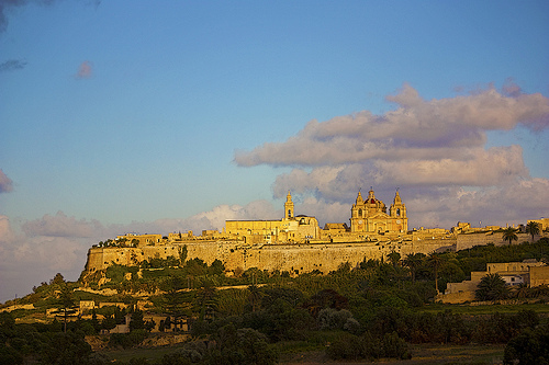
Explore Gzira in Malta
Gzira in the region of Il-Gżira with its 7,513 inhabitants is a town in Malta close to Valletta , the country's capital city .
Current time in Gzira is now 02:00 PM (Monday) . The local timezone is named " Europe/Malta " with a UTC offset of 1 hours. Depending on the availability of means of transportation, these more prominent locations might be interesting for you: Tripoli, Sousse, Vittoria, Syracuse, and Scicli. Since you are here already, make sure to check out Tripoli . We saw some video on the web . Scroll down to see the most favourite one or select the video collection in the navigation. Where to go and what to see in Gzira ? We have collected some references on our attractions page.
Videos
Havy rain in Msida, Malta, September 2012
..
You wait ages for a bus, then they all turn up at once.
The bus strike in Malta caused more problems when on Wednesday at 8am local time the bus drivers protested by driving around Malta in convoy blocking traffic. I shot this from my hotel balcony whilst ..
Malta 2009 ( would you recognize yourself in this video ??? )
Paceville Discos, and St Julian Sun and Splash la mia vacanza a malta ..
Flood in the streets of Malta 03.09.2012 - Überflutete Straßen auf Malta - Għargħar f'Malta
Flood in the streets of Malta 03.09.2012 - a rush of water in the Arriva-Bus ..
Videos provided by Youtube are under the copyright of their owners.
Interesting facts about this location
University of Malta
The University of Malta (Maltese L-Università ta' Malta) is the highest educational institution in Malta offering undergraduate Bachelor's Degrees, postgraduate Master's Degrees and postgraduate Doctorates. It is a member of the Association of Commonwealth Universities. In post-nominals the university's name is abbreviated as Melit. , a shortened form of Melita (A Latinised form of the Greek Μελίτη).
Located at 35.90 14.48 (Lat./Long.); Less than 1 km away
Ta' Ġiorni
Ta' Giorni is one of the subdivisions (informal districts) of St. Julian's, one of the towns in Malta.
Located at 35.92 14.48 (Lat./Long.); Less than 1 km away
Gwardamanġa
Gwardamanġa (sometimes written Guardamangia or Gwarda Mangia), is a hamlet in Tal-Pietà, Malta. In Gwardamanġa is located the St. Luke's Hospital, Malta's former general public hospital.
Located at 35.89 14.49 (Lat./Long.); Less than 2 km away
Fort Manoel
Fort Manoel is a fortification on the island of Malta. It stands on Manoel Island in Marsamxett Harbour to the north west of Valletta and commands the entrance to Marsamxett Harbour and the anchorage of Sliema Creek. Fort Manoel is a star fort, with much of its ditches and walls formed from the native rock of Manoel Island.
Located at 35.90 14.51 (Lat./Long.); Less than 2 km away
Flarestar Observatory
Flarestar Observatory is an astronomical observatory owned and operated by International Astronomical Union (IAU). It is located near San Gwann on the island country of Malta, at {{#invoke:Coordinates|coord}}{{#coordinates:35|54|40|N|014|28|15|E| | |name= }}. Its observatory code is 171.
Located at 35.91 14.47 (Lat./Long.); Less than 2 km away
Pictures


Historical Weather
Related Locations
Information of geographic nature is based on public data provided by geonames.org, CIA world facts book, Unesco, DBpedia and wikipedia. Weather is based on NOAA GFS.