
Delve into Tohopku in Mexico
Tohopku in the region of Yucatán is located in Mexico - some 697 mi or ( 1122 km ) East of Mexico City , the country's capital .
Local time in Tohopku is now 03:55 AM (Sunday) . The local timezone is named " America/Merida " with a UTC offset of -6 hours. Depending on your mobility, these larger destinations might be interesting for you: Xocenpich, Xcantun, Uayma, Piste, and Otial. While being here, you might want to check out Xocenpich . We discovered some clip posted online . Scroll down to see the most favourite one or select the video collection in the navigation. Are you curious about the possible sightseeing spots and facts in Tohopku ? We have collected some references on our attractions page.
Videos
What is inside the Mayan Pyramid of Chichen Itza?
www.mayantravelguide.com : Chichen Itza is monumental archaeological site, which is truly a symbol of wisdom and knowledge. We were able to get inside the Mayan pyramid on this Mayan travel to Chichen ..
Mayan Wonder of the World - Chichen Itza
A short drive from Cancun lies one of the New wonders of the World - Chichen Itza. A YOLO Must See in your lifetime. ..
Tour of Chichen Itza 2010 Yucatan [HD]
Tour of Chichen Itza the Mayan city built without metal tools filemd in Sony 1080i HD. Believe and you can do anything. ..
Ik Kil Cenote Sacred Blue Cenote, by Chichen Itza [HD]
Incredibly blue water is what leaves a lasting impression of the "Sacred Blue Cenote," by Chichen Itza. Almost every tour bus must stop at this attraction but unfortunately it is for only 15 - 20 minu ..
Videos provided by Youtube are under the copyright of their owners.
Interesting facts about this location
Muchucux
Muchucux is a community in the municipality of Chankom in the state of Yucatán, Mexico.
Located at 20.63 -88.45 (Lat./Long.); Less than 3 km away
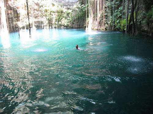
Ik Kil
Ik Kil is a well known cenote outside Pisté in the Municipality of Tinúm, Yucatán, Mexico, It is located in the northern center of the Yucatán Peninsula and is part of the Ik Kil Archeological Park near Chichen Itza. It is open to the public for swimming and is often included in bus tours.
Located at 20.66 -88.55 (Lat./Long.); Less than 9 km away
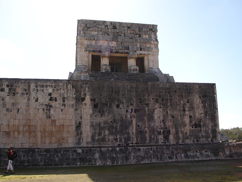
El Castillo, Chichen Itza
El Castillo, also known as the Temple of Kukulkan, is a Mesoamerican step-pyramid that dominates the center of the Chichen Itza archaeological site in the Mexican state of Yucatán. The building is more formally designated by archaeologists as Chichen Itza Structure 5B18.
Located at 20.68 -88.57 (Lat./Long.); Less than 11 km away
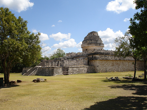
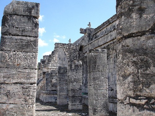
Chichen Itza
Chichen Itza was a large pre-Columbian city built by the Maya civilization. The archaeological site is located in the municipality of Tinum, in the Mexican state of Yucatán. Chichen Itza was a major focal point in the northern Maya lowlands from the Late Classic (c. AD 600–900) through the Terminal Classic (c. AD 800–900) and into the early portion of the Early Postclassic period (c. AD 900–1200).
Located at 20.68 -88.57 (Lat./Long.); Less than 11 km away
Sacred Cenote
The Sacred Cenote (Spanish: cenote sagrado, "sacred well"; alternatively known as the "Well of Sacrifice") refers to a noted cenote at the pre-Columbian Maya archaeological site of Chichen Itza, in the northern Yucatán Peninsula. It is located to the north of Chichen Itza's civic precinct, to which it is connected by a 300-metre sacbe, or raised and paved pathway.
Located at 20.69 -88.57 (Lat./Long.); Less than 12 km away
Pictures


Related Locations
Information of geographic nature is based on public data provided by geonames.org, CIA world facts book, Unesco, DBpedia and wikipedia. Weather is based on NOAA GFS.