-
You are here:
- Homepage »
- Netherlands »
- Utrecht » Maarsbergen

Maarsbergen Destination Guide
Touring Maarsbergen in Netherlands
Maarsbergen in the region of Utrecht with its 1,320 citizens is located in Netherlands - some 31 mi or ( 50 km ) South-East of Amsterdam , the country's capital city .
Time in Maarsbergen is now 02:41 PM (Sunday) . The local timezone is named " Europe/Amsterdam " with a UTC offset of 1 hours. Depending on your budget, these more prominent places might be interesting for you: Woudenberg, Veenendaal, Valkenheide, Utrecht, and Soest. Being here already, consider visiting Woudenberg . We collected some hobby film on the internet . Scroll down to see the most favourite one or select the video collection in the navigation. Check out our recommendations for Maarsbergen ? We have collected some references on our attractions page.
Videos
Cameramount testing on Kawasaki ZXR 400
www.sportbikecam.eu camera mount Testing my cameramount driving High speed on some nice roads in the Netherlands! ..
Mountainbiking Utrechtse Heuvelrug Holland
Short compilation of a mountainbike trip at Utrechtse Heuvelrug shot with a Olympus Mju 6010 SW (nice!). Also my first experimental video-editing, using PiTiVi on Ubuntu Linux. ..
leusden scooters
john : ludix one Kevin : viva city lloyd : thomos revival Edwin : honda dax laurens : achterop ludix (camera man)vanaf 1:40 achterop viva city word pas leuk vanaf 1:40 ;) ..
iGo weehoo trailer part 2
onze zoon is bijna vier jaar, hij kan nu goed mee trappen. Met de gemonteerde drager zijn we er ook mee op fietsvakantie geweest. Vragen? laat even een reactie achter. Our son is almost 4 years old. h ..
Videos provided by Youtube are under the copyright of their owners.
Interesting facts about this location
Maarn
Maarn is a town in the Dutch province of Utrecht. It is a part of the municipality of Utrechtse Heuvelrug, and is located about 10 km east of Zeist. In 2001, the town of Maarn had 4,071 inhabitants. The built-up area of the town was 1.26 km², and contained 1,793 residences. Until 2006, Maarn was a separate municipality, covering both Maarn and Maarsbergen. Maarn is a small village in the heart of the Utrechtse Heuvelrug, a protected nature reserve in the Netherlands.
Located at 52.07 5.37 (Lat./Long.); Less than 3 km away
Utrecht Hill Ridge
Utrecht Hill Ridge is a ridge of low sandhills that stretches in a direction from southeast to northwest over the Dutch province of Utrecht and over a part of North Holland. The total length of the region is about 50 km. It covers an area of approximately 23.000 ha. The part of the ridge in North Holland is commonly called “Het Gooi”. On the southeastern side the ridge rises sharply from the valley of the Nederrijn (“Lower Rhine”).
Located at 52.06 5.35 (Lat./Long.); Less than 4 km away
Breedeveen
Breedeveen is a hamlet in the municipality Utrechtse Heuvelrug, in the Dutch province Utrecht. It lies in a forest north of the village of Leersum, on the road from Leersum to Woudenberg. Breedeveen has a population of 80 (as of 2004).
Located at 52.02 5.42 (Lat./Long.); Less than 4 km away
Grebbe line
The Grebbe Line was a forward defence line of the Dutch Water Line, based on inundation. The Grebbe Line ran from the Grebbeberg in Rhenen northwards until the IJsselmeer.
Located at 52.08 5.46 (Lat./Long.); Less than 5 km away
Doorn
Doorn is a town in the municipality of Utrechtse Heuvelrug in the central Netherlands, in the province of Utrecht. On 1 January 2008 the town had 10,052 inhabitants.
Located at 52.03 5.35 (Lat./Long.); Less than 5 km away
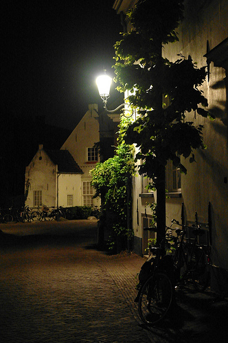
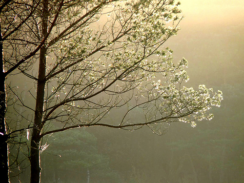
Pictures
Historical Weather
Related Locations
Information of geographic nature is based on public data provided by geonames.org, CIA world facts book, Unesco, DBpedia and wikipedia. Weather is based on NOAA GFS.