-
You are here:
- Homepage »
- Netherlands »
- Utrecht » Rhenen

Rhenen Destination Guide
Explore Rhenen in Netherlands
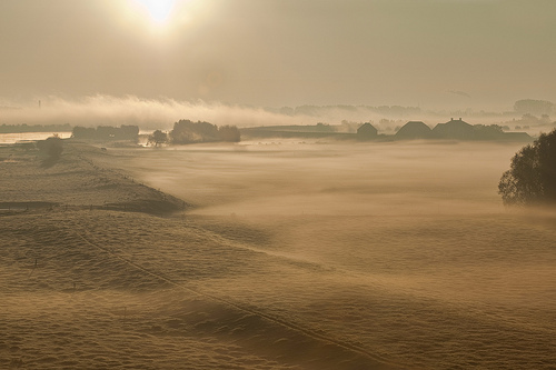
Rhenen in the region of Utrecht with its 18,061 inhabitants is a town in Netherlands - some 41 mi or ( 65 km ) South-East of Amsterdam , the country's capital city .
Current time in Rhenen is now 09:35 PM (Wednesday) . The local timezone is named " Europe/Amsterdam " with a UTC offset of 1 hours. Depending on the availability of means of transportation, these more prominent locations might be interesting for you: Wijchen, Wageningen, Veenendaal, Tiel, and The Hague. Since you are here already, make sure to check out Wijchen . We encountered some video on the web . Scroll down to see the most favourite one or select the video collection in the navigation. Where to go and what to see in Rhenen ? We have collected some references on our attractions page.
Videos
ONK Quad Round #6 - Rhenen
QuadEurope.webs.com Open Dutch Championship Round 6 ..
ACQ Rehearsing for Paradise - a visit to Whale City Sound
In this video you see a cappella quartet Rehearsing for Paradise giving a rehearsal of 'I'm Beginning To See Light'- one of the two songs they sang at the Barbershop Song Festival 2006. Public were th ..
Lightyears from home (techno/experimental/minimal)
A techno track which will take you to the outskirts of the universe. So put on your soundsystem and have a great trip :-D. ..
Avondstemming langs de Waal
Aan de vooravond van de herfst is het nabij Ochten heerlijk vertoeven langs de uiterwaarden en de Waal. ..
Videos provided by Youtube are under the copyright of their owners.
Interesting facts about this location
Cunerakerk
The Cunerakerk is the main church of Rhenen, Netherlands. The church is large because in the Middle Ages it was an important pilgrimage. In the church were stored the relics of the Saint Cunera since the 8th century. The tower has a height of 81.8 meters.
Located at 51.96 5.56 (Lat./Long.); Less than 0 km away
Battle of the Grebbeberg
The Battle of the Grebbeberg (Dutch: Slag om de Grebbeberg) was a major engagement during the Battle of the Netherlands, which was a part of the World War II Operation Fall Gelb in 1940.
Located at 51.95 5.60 (Lat./Long.); Less than 2 km away
De Mars
De Mars is a hamlet in the Dutch province of Gelderland. It is a part of the municipality of Buren, and lies about 8 km south of Veenendaal. The area belonging to De Mars was originally located north of the Rhine river. However, the river bed now runs along a new route north of De Mars. The statistical area "De Mars", which also can include the surrounding countryside, has a population of around 270.
Located at 51.95 5.53 (Lat./Long.); Less than 3 km away
Kesteren
Kesteren is a town in the Dutch province of Gelderland. It is a part of the municipality of Neder-Betuwe, and lies about 8 km southwest of Wageningen. Kesteren was a separate municipality until 2002, when it merged with Dodewaard and Echteld. The new municipality was first called "Kesteren", but changed its name to Neder-Betuwe in 2003. In 2009, the town of Kesteren had 5017 inhabitants. The built-up area of the town was 0.9573 km², and contains 1540 residences.
Located at 51.93 5.57 (Lat./Long.); Less than 3 km away
Lienden
Lienden is a town in the Dutch province of Gelderland. It is a part of the municipality of Buren, and lies about 9 km south of Veenendaal. Lienden was a separate municipality until 1999, when it was merged with Buren. In 2007, the town of Lienden had 6230 inhabitants. The built-up area of the town was 0.81 km², and contained 1147 residences.
Located at 51.95 5.52 (Lat./Long.); Less than 4 km away
Pictures
Historical Weather
Related Locations
Information of geographic nature is based on public data provided by geonames.org, CIA world facts book, Unesco, DBpedia and wikipedia. Weather is based on NOAA GFS.