-
You are here:
- Homepage »
- Republic of the Congo »
- Plateaux » Langalanga
Langalanga Destination Guide
Discover Langalanga in Republic of the Congo
Langalanga in the region of Plateaux is a town located in Republic of the Congo - some 212 mi or ( 341 km ) North of Brazzaville , the country's capital .
Local time in Langalanga is now 09:03 PM (Monday) . The local timezone is named " Africa/Brazzaville " with a UTC offset of 1 hours. Depending on your flexibility, these larger cities might be interesting for you: Pointe-Noire, Loubomo, Brazzaville, Kinshasa, and Langalanga. When in this area, you might want to check out Pointe-Noire . Are you looking for some initial hints on what might be interesting in Langalanga ? We have collected some references on our attractions page.
Videos
Videos provided by Youtube are under the copyright of their owners.
Interesting facts about this location
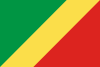
Republic of the Congo
The Republic of the Congo (French: République du Congo), also referred to as Congo-Brazzaville, is a country located in Central Africa. It is bordered by Gabon, Cameroon, the Central African Republic, the Democratic Republic of the Congo and the Angolan exclave of Cabinda. The region was dominated by Bantu-speaking tribes, who built trade links leading into the Congo River basin. Congo-Brazzaville was formerly part of the French colony of Equatorial Africa.
Located at -1.44 15.56 (Lat./Long.); Less than 27 km away
Related Locations
Information of geographic nature is based on public data provided by geonames.org, CIA world facts book, Unesco, DBpedia and wikipedia. Weather is based on NOAA GFS.