-
You are here:
- Homepage »
- United Kingdom »
- England » Chartham

Chartham Destination Guide
Discover Chartham in United Kingdom
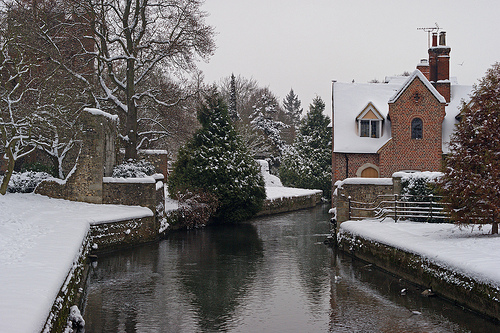
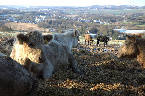
Chartham in the region of England with its 2,836 habitants is a town located in United Kingdom - some 52 mi or ( 84 km ) East of London , the country's capital .
Local time in Chartham is now 10:12 AM (Saturday) . The local timezone is named " Europe/London " with a UTC offset of 0 hours. Depending on your flexibility, these larger cities might be interesting for you: Whitstable, Petham, Lower Hardres, London, and Leysdown-on-Sea. When in this area, you might want to check out Whitstable . We found some clip posted online . Scroll down to see the most favourite one or select the video collection in the navigation. Are you looking for some initial hints on what might be interesting in Chartham ? We have collected some references on our attractions page.
Videos
Bigfoot caught live on video while camping in Chilham woods - monster footage
Whilst camping we caught this footage of what seems to be bigfoot or a close relative nearly attacking our natural habitat territory in Camp wilderness Jubbly's national nature reserve chilham south e ..
Visiting Canterbury England
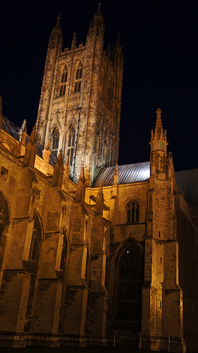
Canterbury is a wonderful city in the region of Kent, set in the area well known as "The Gardens of England" for his beautiful vegetation, flowers, and nice weather. If you fly to any of the Internati ..
Sheerness to Whitstable Motorway M2 England
Timelapse drive from Sheerness A249 along the M2 Motorway and A299 to Whitstable finishing at the Health Centre ..
A Drive Thru The University of Kent at Canterbury England part 1
A drive from the A290 Whitstable Road through the University of Kent, springtime 2011 ..
Videos provided by Youtube are under the copyright of their owners.
Interesting facts about this location
Chartham railway station
Chartham railway station serves Chartham in Kent, England. The station, and all trains serving it, is operated by Southeastern. The station is unmanned, but has two automated information booths, one on each side of the station.
Located at 51.26 1.02 (Lat./Long.); Less than 0 km away
Chilham railway station
Chilham railway station serves the area around the village of Chilham in Kent, England, including Chilham itself, Shottenden, Old Wives Lees, Selling and Bagham. The station, and all trains serving it, are operated by Southeastern. The station was opened by the South Eastern Railway (SER) on 1 December 1846, and is on the SER Ashford to Margate line. The platforms are connected by a concrete footbridge - a typical product of the Southern Railway concrete factory at Exmouth Junction.
Located at 51.24 0.98 (Lat./Long.); Less than 3 km away
Julliberrie's Grave
Julliberrie's Grave is an unchambered earthen Neolithic long barrow in the English county of Kent. It is situated near Chilham overlooking the River Stour on the Julliberrie Downs at Ordnance Survey, grid reference TR077532. The Stour Valley Walk passes close to the site. It is 44 metres in length, 2 metres high and measures 15 metres at its widest although it was originally longer. Eighteenth century chalk extraction has destroyed the northern end.
Located at 51.24 0.97 (Lat./Long.); Less than 4 km away
Canterbury Castle
Canterbury Castle is a Norman Castle in Canterbury, Kent, England. It is a five-minute walk from Canterbury East Station and main bus station around City Wall. Canterbury Castle was one of the three original Royal castles of Kent. They were all built soon after the Battle of Hastings, on the main Roman road from Dover to London. This was the route taken by William the Conqueror in October 1066, and they were built originally as motte-and-bailey castles to guard this important route.
Located at 51.28 1.07 (Lat./Long.); Less than 4 km away
Canterbury East railway station
Canterbury East railway station is one of two stations in Canterbury in Kent, England. It is south-southwest of the city centre and is served by Southeastern. The station and its line were built by London, Chatham and Dover Railway, while Canterbury West was built by South Eastern Railway. Although called Canterbury East the station is about ½ a mile due south of Canterbury West station, and only about twenty yards to its east.
Located at 51.27 1.08 (Lat./Long.); Less than 4 km away
Pictures
Historical Weather
Related Locations
Information of geographic nature is based on public data provided by geonames.org, CIA world facts book, Unesco, DBpedia and wikipedia. Weather is based on NOAA GFS.