-
You are here:
- Homepage »
- United Kingdom »
- N Ireland » Greenisland

Greenisland Destination Guide
Explore Greenisland in United Kingdom
Greenisland in the region of N Ireland with its 5,073 inhabitants is a place in United Kingdom - some 324 mi or ( 522 km ) North-West of London , the country's capital city .
Time in Greenisland is now 05:51 AM (Thursday) . The local timezone is named " Europe/London " with a UTC offset of 0 hours. Depending on your budget, these more prominent locations might be interesting for you: Woodburn, Whitehouse Lower, Whiteabbey, Newtownabbey, and Manchester. Since you are here already, consider visiting Woodburn . We saw some hobby film on the internet . Scroll down to see the most favourite one or select the video collection in the navigation. Where to go and what to see in Greenisland ? We have collected some references on our attractions page.
Videos
12th July 2008 Bonfire, Carrickfergus, Northern Ireland
Bonfire at Castlemara, Carrickfergus. 12/0708 ..
1. March 2009. Landing @ Belfast City Airport
BMI flight 88 London Heathrow - Belfast City Airport. 1st of March, 2009 ..
8000-series DMU passes through Whiteabbey
A DMU series 8000 passes through the Whiteabbey NIR (Northern Irish Railway) but does not call at this station. ..
Ryanair B737-800 - Landing at Belfast City
Landing at Belfast City Airport on a Ryanair 737-800 after a short jump over from Glasgow Prestwick. A windy afternoon in July 2008. Was quite a bumpy approach hence the shaky camera hand so sorry abo ..
Videos provided by Youtube are under the copyright of their owners.
Interesting facts about this location
Greenisland railway station
Greenisland railway station serves Greenisland in County Antrim, Northern Ireland. The station opened on 11 April 1848 as Carrickfergus Junction. It was renamed on 10 January 1893. The station used to be larger, with a third platform, but this was removed after the closure of the spur to the Londonderry Line. The station building is manned from 7am in the morning to 3pm in the afternoon. A park and ride facility was built in 2009.
Located at 54.70 -5.87 (Lat./Long.); Less than 0 km away
A2 road (Northern Ireland)
The A2 is a major road in Northern Ireland, a considerable length of which is often referred to the Antrim Coast Road because it follows the scenic coastline of County Antrim. Mainly a single lane in each direction, the road follows most of the coastline of Northern Ireland. It is connected in several places to other major roads.
Located at 54.68 -5.88 (Lat./Long.); Less than 2 km away
Jordanstown railway station
Jordanstown railway station serves Jordanstown and the University of Ulster in Newtownabbey, Northern Ireland. A park and ride facility for the station has been proposed to ease congestion on the main Jordanstown Road. The station was opened on 1 February 1853. The station buildings were demolished in the 1980s and replaced by modest shelters. Prior to this, the station was staffed permanently and had a manually operated level crossing.
Located at 54.69 -5.90 (Lat./Long.); Less than 2 km away
Monkstown, County Antrim
Monkstown is the name of a townland and electoral ward in County Antrim, Northern Ireland. It is within the urban area called Newtownabbey and the wider Newtownabbey Borough. The townland was previously called Ballynamanagh The settlement used to be quite small, but has recently seen some major developments in both jobs and new housing estates. The Community school serves as both school and as community centre. Canadian-owned company, Nortel Networks, had a factory in Monkstown.
Located at 54.68 -5.90 (Lat./Long.); Less than 2 km away
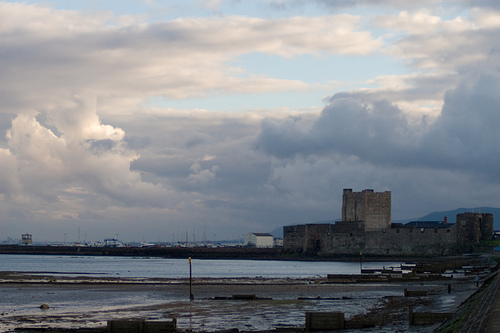
Carrickfergus Waterfront
Carrickfergus Waterfront is an area of Carrickfergus situated on the north shore of Belfast Lough, which includes two harbour facilities, several restaurants and bars and promenade areas. The waterfront area is mainly composed of two harbour facilities, a harbour and a marina. Both harbours feature rugged rubble stone breakwaters, absorbing energy from heavy swells.
Located at 54.71 -5.82 (Lat./Long.); Less than 3 km away
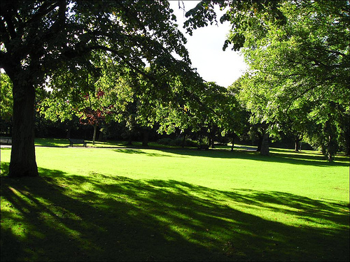
Pictures

Related Locations
Information of geographic nature is based on public data provided by geonames.org, CIA world facts book, Unesco, DBpedia and wikipedia. Weather is based on NOAA GFS.