-
You are here:
- Homepage »
- United Kingdom »
- N Ireland » Greyabbey

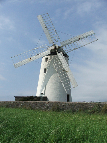
Greyabbey Destination Guide
Explore Greyabbey in United Kingdom
Greyabbey in the region of N Ireland with its 1,030 inhabitants is a town in United Kingdom - some 308 mi or ( 495 km ) North-West of London , the country's capital city .
Current time in Greyabbey is now 09:19 PM (Tuesday) . The local timezone is named " Europe/London " with a UTC offset of 0 hours. Depending on the availability of means of transportation, these more prominent locations might be interesting for you: Six Road Ends, Portavogie, Portaferry, Newtownards, and Manchester. Since you are here already, make sure to check out Six Road Ends . We encountered some video on the web . Scroll down to see the most favourite one or select the video collection in the navigation. Where to go and what to see in Greyabbey ? We have collected some references on our attractions page.
Videos
Greenday Karaoke Basket Case metal vid
karaokesongs4u.com Greenday Karaoke Basket Case metal videos ..
forked lightning over bangor northern ireland
i was lucky to catch this video of forked lightning last month which as you will see if i hadnt moved my camera when i did i would have missed it completely. watch upper left of screen between 20 and ..
12th July Parades - Donaghadee (2012)
The Orangemen March ..
Speed Your Journey
Another chorus from our April 2007 concert - the well loved "Speed Your Journey" from "Nabucco" by Verdi ..
Videos provided by Youtube are under the copyright of their owners.
Interesting facts about this location
Grey Abbey
Grey Abbey is a ruined Cistercian priory in the village of Greyabbey, County Down, Northern Ireland, currently maintained by the Northern Ireland Environment Agency. It is a monument in state care in the townland of Rosemount, beside the Rosemount estate, on the eastern edge of the village of Greyabbey in the Borough of Ards, at grid ref: J5829 6810.
Located at 54.54 -5.56 (Lat./Long.); Less than 1 km away
A20 road (Northern Ireland)
The A20 is a road in Northern Ireland. It runs from Belfast to Newtownards and on to Portaferry in County Down. Beginning as the Newtownards Road at the junction of Bridge End close to Belfast city centre, the road runs in an easterly direction through east Belfast. The early parts of the road are mainly working-class Protestant districts with strong links to the nearby Harland & Wolff shipyard.
Located at 54.50 -5.54 (Lat./Long.); Less than 4 km away
Carrowdore
Carrowdore (from Irish: Ceathrú Dobhair, meaning "water quarter") is a small village on the Ards Peninsula in County Down, Northern Ireland. It is situated in the townland of Ballyrawer, the civil parish of Donaghadee and the historic barony of Ards Lower. It lies within the Borough of Ards. Its population as recorded by the 2001 Census was 816.
Located at 54.57 -5.55 (Lat./Long.); Less than 4 km away
North Down and Ards
North Down and Ards District is a proposed Northern Ireland local government district. The district is to have been created by merging Borough of Ards and Borough of North Down, though a small area of the Knocknagoney area of North Down District was to be transferred to City of Belfast. The new district will cover the Ards Peninsula and the southern shore of Belfast Lough. The region would have an electorate of 102,313. The name of the new district was recommended on 17 September 2008.
Located at 54.56 -5.64 (Lat./Long.); Less than 6 km away
Ards Peninsula
The Ards Peninsula (from Irish: nAird Uladh, meaning "peninsula of the Ulstermen") is a peninsula in County Down, Northern Ireland, which separates Strangford Lough from the North Channel of the Irish Sea on Ireland's north-east coast. A number of towns and villages are located on the peninsula such as the seaside town of Donaghadee, with the surrounding area known as the Ards district.
Located at 54.50 -5.50 (Lat./Long.); Less than 6 km away
Pictures
Related Locations
Information of geographic nature is based on public data provided by geonames.org, CIA world facts book, Unesco, DBpedia and wikipedia. Weather is based on NOAA GFS.