-
You are here:
- Homepage »
- United States »
- Oregon » Port Orford

Port Orford Destination Guide
Explore Port Orford in United States
Port Orford in the region of Oregon with its 1,133 inhabitants is a town in United States - some 2,463 mi or ( 3964 km ) West of Washington , the country's capital city .
Current time in Port Orford is now 06:39 PM (Wednesday) . The local timezone is named " America/Los Angeles " with a UTC offset of -7 hours. Depending on the availability of means of transportation, these more prominent locations might be interesting for you: Crescent City, Coquille, Denmark, Eugene, and Grants Pass. Since you are here already, make sure to check out Crescent City . We saw some video on the web . Scroll down to see the most favourite one or select the video collection in the navigation. Where to go and what to see in Port Orford ? We have collected some references on our attractions page.
Videos
Sneaker Wave Caught Me! - Oregon Coast Trip 2011
www.romantic-oregon-coast.com A surfer, NASCAR at the beach, and a sneaker wave. More fun at the Oregon coast! Follow me on Twitter! http Subscribe to my new Portland channel! www.youtube.com Subscrib ..
Part 1: 2009 4th of July Parade in Port Orford, Oregon
Possibly the greatest show on earth, if not in Port Orford, along Oregon's South Coast. This is Part 1 of this small town's parade on the 4th of July, 2009. ..
Giant Boats In Danger! - More Oregon Coast Trip 2011
www.romantic-oregon-coast.com Our Oregon coast trip continues as we hit one of the only dolly docks in the world. Very cool! Follow me on Twitter! http Subscribe to my new Portland channel! www.youtub ..
Forest Banshees Attack? - Oregon Coast Trip Continues
Enjoying the Oregon coast, but heeding the warning of a possible Forest Banshee attack. You never know. Follow me on Twitter! www.twitter.com Subscribe to my new Portland channel! www.youtube.com Subs ..
Videos provided by Youtube are under the copyright of their owners.
Interesting facts about this location
The Heads (Oregon)
This article about the geographical entity. For the American band, see Talking Heads post-breakup, for the UK stoner rock band, see The Heads (UK band) The Heads is a rocky cape on the Pacific Ocean coast of southwestern Oregon in the United States. It is located in northern Curry County, just outside the town of Port Orford, along a mountainous stretch of coast bounded to the east by the Coastal Range. The cape is part of Port Orford Heads State Park.
Located at 42.74 -124.51 (Lat./Long.); Less than 1 km away
Humbug Mountain
Humbug Mountain lies on the southern coast of the U.S. state of Oregon. It is located about 6 miles south of Port Orford, and 21 miles north of Gold Beach, on the Pacific Ocean. The mountain is completely within Humbug Mountain State Park, and U.S. Route 101 passes by its northern base. It is one of the highest mountains in Oregon to rise directly from the ocean. Its slopes feature an old-growth temperate rainforest.
Located at 42.68 -124.44 (Lat./Long.); Less than 9 km away
Pacific High School (Port Orford, Oregon)
Pacific High School is a public high school in Port Orford, Oregon, United States.
Located at 42.85 -124.47 (Lat./Long.); Less than 11 km away
Curry County, Oregon
Curry County is a county located in the U.S. state of Oregon. In 2010, its population was 22,364. The county is named for George Law Curry, a governor of the Oregon Territory. The seat of the county is Gold Beach.
Located at 42.84 -124.57 (Lat./Long.); Less than 11 km away
Cape Blanco (Oregon)
Cape Blanco is a prominent headland on the Pacific Ocean coast of southwestern Oregon in the United States, forming the westernmost point in the state. It contests with Cape Alava in Washington for the title of westernmost point in the contiguous United States. This contention is due to land shifts and measurement anomalies as well as whether to measure at high or low tide.
Located at 42.84 -124.56 (Lat./Long.); Less than 12 km away
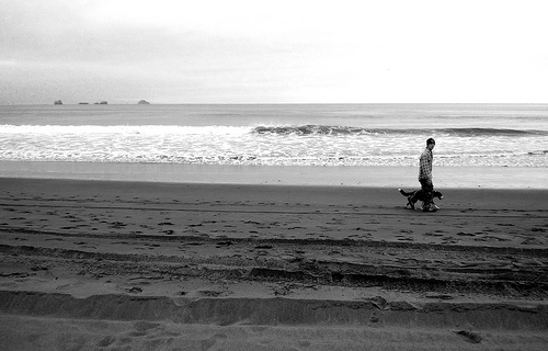
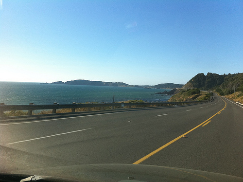
Pictures
Related Locations
Information of geographic nature is based on public data provided by geonames.org, CIA world facts book, Unesco, DBpedia and wikipedia. Weather is based on NOAA GFS.