-
You are here:
- Homepage »
- United States »
- Washington » Coulee City

Coulee City Destination Guide
Explore Coulee City in United States
Coulee City in the region of Washington with its 562 inhabitants is a town in United States - some 2,180 mi or ( 3509 km ) West of Washington , the country's capital city .
Current time in Coulee City is now 10:40 AM (Tuesday) . The local timezone is named " America/Los Angeles " with a UTC offset of -7 hours. Depending on the availability of means of transportation, these more prominent locations might be interesting for you: Boise, Portland, Bacon, Davenport, and Ellensburg. Since you are here already, make sure to check out Boise . We encountered some video on the web . Scroll down to see the most favourite one or select the video collection in the navigation. Where to go and what to see in Coulee City ? We have collected some references on our attractions page.
Videos
Dry Falls in Sun Lakes State Park Eastern Washington August 2009
Dry Falls in Sun Lakes State Park Eastern Washington August 2009. Ancient waterfall that is no longer active. Incredible canyon country. ..
Dry Falls - Home of The World's Largest Waterfall Drfumblefinger's photos, United States
Preview of Drfumblefinger's blog at TravelPod. Read the full blog here: www.travelpod.com This blog preview was made by TravelPod using the TripAdvisor™ TripWow slideshow creator. Learn more about the ..
Panoramic video of Dry Falls from Visitors Center, Washington state
Dry Falls was a waterfall that was active when the area was flooded by the release of an enormous body of water during the Pleistocene Era. Some say that it took just weeks for a volume of water the s ..
Dry Falls Washington from its Visitors Center
A panoramic view of Dry Falls Washington. See en.wikipedia.org for more about Dry Falls. See en.wikipedia.org for more about how this entire area was formed. ..
Videos provided by Youtube are under the copyright of their owners.
Interesting facts about this location
Coulee City, Washington
Coulee City is a town in Grant County, Washington, United States. The population was 562 at the 2010 census.
Located at 47.61 -119.29 (Lat./Long.); Less than 0 km away
Banks Lake
Banks Lake is a 27-mile long reservoir in central Washington in the United States. Part of the Columbia Basin Project, Banks Lake occupies the northern portion of the Grand Coulee, a formerly dry coulee near the Columbia River, formed by the Missoula Floods during the Pleistocene epoch. Grand Coulee Dam, built by the United States Bureau of Reclamation on the Columbia River created Franklin D. Roosevelt Lake, the reservoir on the river behind the dam.
Located at 47.62 -119.31 (Lat./Long.); Less than 2 km away
Dry Falls Dam
Dry Falls Dam is a rockfaced earthfill-type dam in the U.S. state of Washington. Located in Grant County near Coulee City, it was built as part of the Bureau of Reclamation's Columbia Basin Project. Water from the Columbia River, impounded by Grand Coulee Dam, is pumped into Grand Coulee, a formerly dry canyon, via the short Feeder Canal. Grand Coulee's north end is sealed by North Dam and Dry Falls Dam stretches across the midsection of the Coulee.
Located at 47.62 -119.31 (Lat./Long.); Less than 2 km away
Banks Lake South, Washington
Banks Lake South is a census-designated place (CDP) in Grant County, Washington, United States. The population was 160 at the 2000 census.
Located at 47.63 -119.28 (Lat./Long.); Less than 2 km away
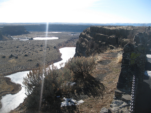
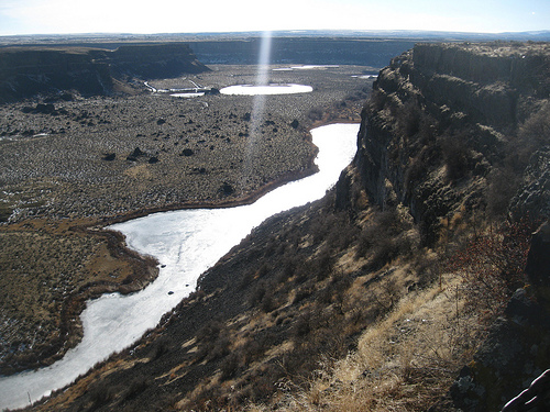
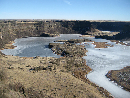
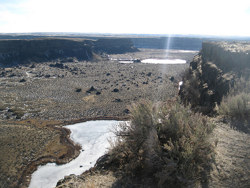
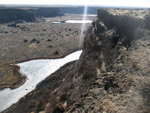
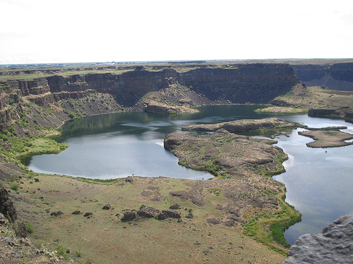
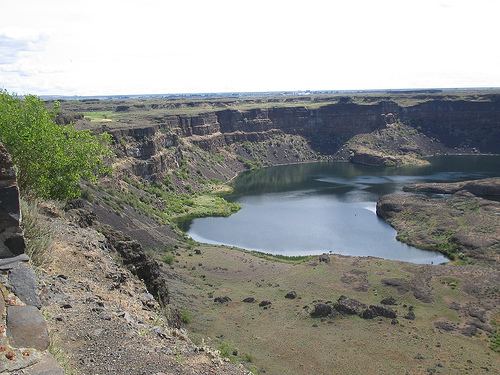
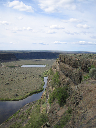
Dry Falls
Dry Falls is a 3.5 mile long scalloped precipice in central Washington, on the opposite side of the Upper Grand Coulee from the Columbia River, and at the head of the Lower Grand Coulee. Ten times the size of Niagara, Dry Falls is thought to be the greatest known waterfall that ever existed. According to the current geological model, catastrophic flooding channeled water at 65 miles per hour through the Upper Grand Coulee and over this 400-foot rock face at the end of the last ice age.
Located at 47.61 -119.35 (Lat./Long.); Less than 5 km away
Pictures

Related Locations
Information of geographic nature is based on public data provided by geonames.org, CIA world facts book, Unesco, DBpedia and wikipedia. Weather is based on NOAA GFS.