-
You are here:
- Homepage »
- United States »
- Washington » Ridgefield

Ridgefield Destination Guide
Discover Ridgefield in United States
Ridgefield in the region of Washington with its 4,763 habitants is a town located in United States - some 2,349 mi or ( 3780 km ) West of Washington , the country's capital .
Local time in Ridgefield is now 09:53 AM (Monday) . The local timezone is named " America/Los Angeles " with a UTC offset of -7 hours. Depending on your flexibility, these larger cities might be interesting for you: Columbia Heights, Corvallis, Deer Island, Eugene, and McNulty. When in this area, you might want to check out Columbia Heights . We found some clip posted online . Scroll down to see the most favourite one or select the video collection in the navigation. Are you looking for some initial hints on what might be interesting in Ridgefield ? We have collected some references on our attractions page.
Videos
I'm Gonna See My Friend
Opener for the Clark County Amphitheater show in Ridgefield, WA - September 27, 2009. From the new album "Backspacer" ..
Portland to Anderson Island
Starting at a rest stop 30 min North of Porland, OR - I put a cam on the dash and dashed to Anderson Island, Wa. Stopped for gas once. ..
Memorial Day Camp 2009 (Part 1)
On Friday Michele and I arrived right after Holly, Steve, Scarlett and Jolie did. We set up camp, cooked and ate food and explored our campground a bit. On Saturday Melanie, Craig and Jolie showed up ..
Test shoot: Columbia River Gorge Waterfalls
8-10-07 Creation Explorers have begun filming screen tests for thier 'Globtrekkers' style documentary about the Missoula Flood's effects within the Columbia River Gorge. ..
Videos provided by Youtube are under the copyright of their owners.
Interesting facts about this location
Ridgefield, Washington
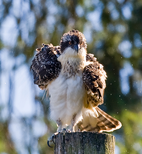
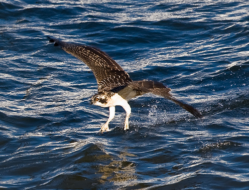
Ridgefield is a city in the pastoral, rolling-hills countryside of northern Clark County, Washington, United States. The population was 4,763 at the 2010 census. Ridgefield is notable for the significant Native American and Lewis and Clark Expedition history of the area, but is also the home of the Ridgefield National Wildlife Refuge, a primary reserve for migrating waterfowl on the Pacific Flyway, and the Ridgefield High School "Spudders" (reflecting the area's potato-farming heritage).
Located at 45.82 -122.73 (Lat./Long.); Less than 1 km away
Ridgefield High School (Ridgefield, Washington)
Ridgefield High School, known as RHS, is the single 4-year high school serving the Ridgefield School District in Clark County, Washington. The school is located approximately one mile south of downtown Ridgefield. The team mascot is the Spudder, made famous by appearing on David Letterman's "Top Ten Worst Mascots" and other unusual mascot lists.
Located at 45.80 -122.71 (Lat./Long.); Less than 3 km away
Collins Beach (Sauvie Island)
Collins Beach is a sandy beach on the Columbia River side of Sauvie Island in Oregon, United States, located north of Portland. Part of it is a clothing-optional area. The beach is one mile (1.6 km) long and begins about 0.25 miles after Reeder Road becomes gravel. Hours are 04:00 a.m. to 10:00 p.m. every day. The beach has been popular for nude use since at least the 1970s.
Located at 45.79 -122.79 (Lat./Long.); Less than 4 km away
Gee Creek (Washington)
Gee Creek is a 4th order tributary to the Columbia River, a.k.a. small creek, within Clark County, Washington named for William Gee, an early pioneer upon whose land the stream arose from. The Upper Gee Creek watershed, with an 8.7-square-mile drainage basin, is completely located within the Ridgefield quadrangle. The mainstem extends approximately 11.5 miles, of which 4.9 miles are located within the Upper Gee Creek basin.
Located at 45.80 -122.69 (Lat./Long.); Less than 5 km away
Gilbert River (Oregon)
The Gilbert River is a river on Sauvie Island in the U.S. state of Oregon which flows from Sturgeon Lake into the Multnomah Channel of the Willamette River.
Located at 45.79 -122.80 (Lat./Long.); Less than 5 km away
Pictures
Related Locations
Information of geographic nature is based on public data provided by geonames.org, CIA world facts book, Unesco, DBpedia and wikipedia. Weather is based on NOAA GFS.