-
You are here:
- Homepage »
- France »
- Basse-Normandie » Pontorson

Pontorson Destination Guide
Explore Pontorson in France
Pontorson in the region of Basse-Normandie with its 4,147 inhabitants is a town in France - some 177 mi or ( 285 km ) West of Paris , the country's capital city .
Current time in Pontorson is now 10:16 PM (Sunday) . The local timezone is named " Europe/Paris " with a UTC offset of 1 hours. Depending on the availability of means of transportation, these more prominent locations might be interesting for you: London, Cambridge, Bristol, Birmingham, and Vannes. Since you are here already, make sure to check out London . We saw some video on the web . Scroll down to see the most favourite one or select the video collection in the navigation. Where to go and what to see in Pontorson ? We have collected some references on our attractions page.
Videos
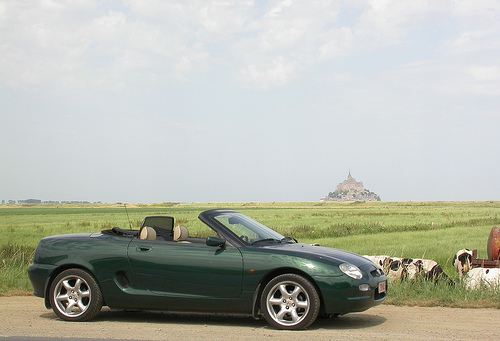
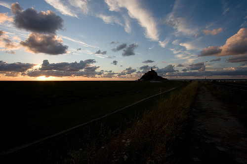
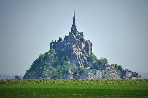
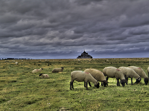
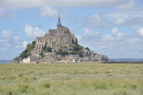
Le Mont-Saint-Michel and its bay
Mont-Saint-Michel and the bay surrounding it are located on the northwest coast of France, on the border between Normandy and Brittany. The effect of tides and sandbars down the ages has given the are ..
R1200RT BRETAÑA.AVI
Camino al Mont Saint Michael ..
Mont St. Michel from the new Couesnon barrage
This is a view of Mont St. Michel from the river Couesnon. ..
le mont saint michel
on the way ..
Videos provided by Youtube are under the copyright of their owners.
Interesting facts about this location
Pontorson Airfield
Pontorson Airfield is an abandoned World War II military airfield, which is located near the commune of Pontorson in the Basse-Normandie region of northern France. Located just outside of Pontorson (likely to the northeast), the United States Army Air Force established a temporary airfield on 7 August 1944, shortly after the Allied landings in France The airfield was constructed by the IX Engineering Command, 819th Engineer Aviation Battalion.
Located at 48.54 -1.50 (Lat./Long.); Less than 1 km away
Couesnon
The Couesnon River is a river running from the département of Mayenne in north-western France, forming an estuary at Mont Saint-Michel. Its final stretch forms the border between the historical duchies of Normandy and Brittany.
Located at 48.62 -1.51 (Lat./Long.); Less than 7 km away
Tombelaine
Tombelaine is a small tidal island off the coast of Normandy in France. It lies a few kilometres north of Mont Saint-Michel. At low tide the island can be reached on foot (with a guide) from the coast of Cotentin, 3.5 km to the north-east, and from Mont Saint-Michel. The island lies just to the south of the course of the Sélune river, which has to be forded to access the island from Cotentin. The island is 250 metres by 150 metres, and 45 metres high. It is composed of granite.
Located at 48.66 -1.51 (Lat./Long.); Less than 12 km away
Sélune
Selûne is a fictional goddess in the Forgotten Realms setting of Dungeons & Dragons. Also known as Our Lady of Silver and the Moonmaiden, she is the Faerûnian goddess of light, the moon, stars, navigation, navigators, wanderers, questers, and goodly lycanthropes. Clerics of Selûne are a very diverse group, including sailors, nonevil lycanthropes, mystics, and female spellcasters.
Located at 48.65 -1.40 (Lat./Long.); Less than 13 km away
Saint James Airfield
Saint James Airfield is an abandoned World War II military airfield, which is located near the commune of Saint-James in the Brittany region of northern France. Located just outside of Saint-James, the United States Army Air Force established a temporary airfield on 8 August 1944, shortly after the Allied landings in France The airfield was constructed by the IX Engineering Command, 825th Engineer Aviation Battalion.
Located at 48.52 -1.32 (Lat./Long.); Less than 14 km away
Pictures
Related Locations
Information of geographic nature is based on public data provided by geonames.org, CIA world facts book, Unesco, DBpedia and wikipedia. Weather is based on NOAA GFS.