
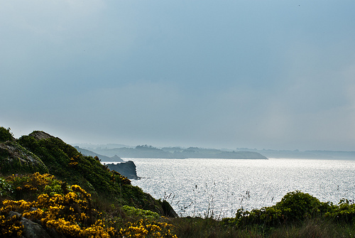
Touring Cancale in France
Cancale in the region of Bretagne with its 5,751 citizens is located in France - some 192 mi or ( 308 km ) West of Paris , the country's capital city .
Time in Cancale is now 03:19 PM (Friday) . The local timezone is named " Europe/Paris " with a UTC offset of 1 hours. Depending on your budget, these more prominent places might be interesting for you: Oxford, London, Cambridge, Bristol, and Birmingham. Being here already, consider visiting Oxford . We collected some hobby film on the internet . Scroll down to see the most favourite one or select the video collection in the navigation. Check out our recommendations for Cancale ? We have collected some references on our attractions page.
Videos
Pont Grouin
Bretagne in der Nähe von Cancale ..
CANCALE HUITRES.wmv
A CANCALE PER MANGIARE OSTRICHE SUL MURETTO -HUITRES A CANCALE OYSTERS IN CANCALE ..
La bisquine-(old gaffers 2004).mp4
Arrivée de la bisquine "CAN 87" à Cancale lors du rassemblement de vieux gréements "OLD GAFFERS 2004". ..
Rassemblement de vieux gréements-(old gaffers 2004).mp4
Rassemblement de vieux gréements à Cancale. (2004) ..
Videos provided by Youtube are under the copyright of their owners.
Interesting facts about this location
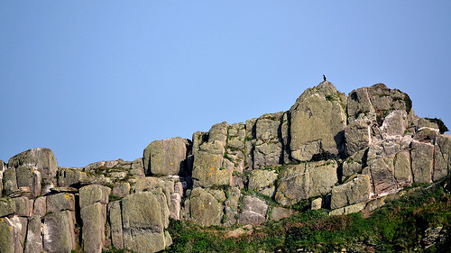
Pointe du Grouin
The rocky finger of the Pointe du Grouin points out and protects the entrance into the bay of Mont Saint-Michel. On this headland, a Grande Randonnée runs around hugging the cliff face and there is a circular walk starting out from Cancale. On their way the walker can enjoy views of the Île des Landes a long barren outcrop (now a bird sanctuary), the lighthouse, the Îles Chausey, Granville on the Normandy coast, and, on a clear day, the outline of Mont Saint-Michel.
Located at 48.71 -1.84 (Lat./Long.); Less than 4 km away
Rothéneuf
Rothéneuf is a village in the north west of France, situated north-east from Saint-Malo, about five kilometres alongside the coast. Administratively, it is part of the commune of Saint-Malo, in the département of Ille-et-Vilaine. The village is a seaside resort but is famous for its sculpted rocks, "rochers sculptés". Abbé Fouré (1839-1910), having suffered a stroke at the age of 30, which left him paralyzed on one side, retreated to a life as a hermit in the cliffs of Rothéneuf.
Located at 48.68 -1.97 (Lat./Long.); Less than 9 km away
Paramé
Paramé is a former town and commune of France on the north coast of Britanny. The town merged with Saint-Servan into the commune of Saint-Malo in 1967. Paramé is now a quarter of Saint-Malo and its seaside resort. The city is known for its long sand beach and its sea spa.
Located at 48.67 -2.00 (Lat./Long.); Less than 11 km away
Agglomeration community of Pays de Saint-Malo
The Agglomeration community of Pays de Saint-Malo (French: Communauté d'agglomération du Pays de Saint-Malo), is the intercommunal structure gathering the commune of Saint-Malo in France and 17 neighbouring communes.
Located at 48.60 -1.95 (Lat./Long.); Less than 11 km away
Saint-Servan
Saint-Servan is a town of western France, in Brittany, situated 2 miles from the ferry port of St Malo. It is renowned for its lovely shops and restaurants. In June 1758, during the Seven Years War, the town was captured by British troops as part of the Raid on St Malo. The British burnt 30 privateers and a hundred other ships before withdrawing. Its population in 1906 was 1,965. The commune of Saint-Servan was merged, together with Paramé, into the commune of Saint-Malo in 1967.
Located at 48.64 -2.01 (Lat./Long.); Less than 13 km away
Pictures

Related Locations
Information of geographic nature is based on public data provided by geonames.org, CIA world facts book, Unesco, DBpedia and wikipedia. Weather is based on NOAA GFS.