
Touring Saint-Coulomb in France
Saint-Coulomb in the region of Bretagne with its 2,398 citizens is located in France - some 194 mi or ( 313 km ) West of Paris , the country's capital city .
Time in Saint-Coulomb is now 02:01 PM (Monday) . The local timezone is named " Europe/Paris " with a UTC offset of 1 hours. Depending on your budget, these more prominent places might be interesting for you: Oxford, London, Cambridge, Bristol, and Birmingham. Being here already, consider visiting Oxford . We collected some hobby film on the internet . Scroll down to see the most favourite one or select the video collection in the navigation. Check out our recommendations for Saint-Coulomb ? We have collected some references on our attractions page.
Videos
Pont Grouin
Bretagne in der Nähe von Cancale ..
CANCALE HUITRES.wmv
A CANCALE PER MANGIARE OSTRICHE SUL MURETTO -HUITRES A CANCALE OYSTERS IN CANCALE ..
una mirada sobre bretaña
fotografías de Bretaña, dpto. de Ille et Vilaine, música bretona ..
La bisquine-(old gaffers 2004).mp4
Arrivée de la bisquine "CAN 87" à Cancale lors du rassemblement de vieux gréements "OLD GAFFERS 2004". ..
Videos provided by Youtube are under the copyright of their owners.
Interesting facts about this location
Rothéneuf
Rothéneuf is a village in the north west of France, situated north-east from Saint-Malo, about five kilometres alongside the coast. Administratively, it is part of the commune of Saint-Malo, in the département of Ille-et-Vilaine. The village is a seaside resort but is famous for its sculpted rocks, "rochers sculptés". Abbé Fouré (1839-1910), having suffered a stroke at the age of 30, which left him paralyzed on one side, retreated to a life as a hermit in the cliffs of Rothéneuf.
Located at 48.68 -1.97 (Lat./Long.); Less than 4 km away
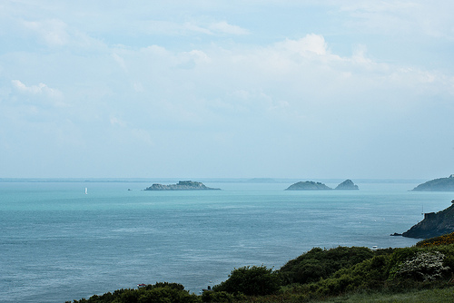
Pointe du Grouin
The rocky finger of the Pointe du Grouin points out and protects the entrance into the bay of Mont Saint-Michel. On this headland, a Grande Randonnée runs around hugging the cliff face and there is a circular walk starting out from Cancale. On their way the walker can enjoy views of the Île des Landes a long barren outcrop (now a bird sanctuary), the lighthouse, the Îles Chausey, Granville on the Normandy coast, and, on a clear day, the outline of Mont Saint-Michel.
Located at 48.71 -1.84 (Lat./Long.); Less than 6 km away
Paramé
Paramé is a former town and commune of France on the north coast of Britanny. The town merged with Saint-Servan into the commune of Saint-Malo in 1967. Paramé is now a quarter of Saint-Malo and its seaside resort. The city is known for its long sand beach and its sea spa.
Located at 48.67 -2.00 (Lat./Long.); Less than 7 km away
Gare de Saint-Malo
Gare de Saint-Malo is a railway station serving the town Saint-Malo, Ille-et-Vilaine department, western France. The station is situated on the Rennes–Saint-Malo railway.
Located at 48.65 -2.00 (Lat./Long.); Less than 8 km away
Fort National
Fort National is a Fort just outside the walled city of Saint-Malo. It was built in 1689.
Located at 48.65 -2.02 (Lat./Long.); Less than 9 km away
Pictures

Related Locations
Information of geographic nature is based on public data provided by geonames.org, CIA world facts book, Unesco, DBpedia and wikipedia. Weather is based on NOAA GFS.