-
You are here:
- Homepage »
- Mauritius »
- Pamplemousses » Fond du Sac
Fond du Sac Destination Guide
Delve into Fond du Sac in Mauritius
Fond du Sac in the region of Pamplemousses with its 5,796 residents is located in Mauritius - some 10 mi or ( 16 km ) North-East of Port Louis , the country's capital .
Local time in Fond du Sac is now 07:26 PM (Tuesday) . The local timezone is named " Indian/Mauritius " with a UTC offset of 4 hours. Depending on your mobility, these larger destinations might be interesting for you: Triolet, The Vale, Tamarin, Souillac, and Rouge Terre. While being here, you might want to check out Triolet . We discovered some clip posted online . Scroll down to see the most favourite one or select the video collection in the navigation. Are you curious about the possible sightseeing spots and facts in Fond du Sac ? We have collected some references on our attractions page.
Videos
Mauritius
Video from a trip to Mauritius in March 2009, filmed with a Canon SX1. ..
Resamaurice : Hotel Veranda Grand Baie, île Maurice
www.resamaurice.com lespécialiste des hôtels de lîle Maurice. Toute une équipe basée à lîle Maurice, qui visite tous les hôtels, pour mieux vous conseiller et vous aider à préparer votre séjour. Deman ..
Ile Maurice : Le nord de l'île
Tourismes.tv vous emmène en Ile Maurice au nord de l'île découvrir ses paysages et ses activités et son art de recevoir à travers trois sites : La Maison Euréka, La Grande Baie et l'Ilot Gabriel. Plus ..
Mauritius (Ile Maurice)
Mauritius is a small African island East of Madagascar. This is a montage of four trips there and the wild beauty that pervades this extraordinary land. The island is in the Southern hemisphere, and r ..
Videos provided by Youtube are under the copyright of their owners.
Interesting facts about this location
Triolet, Mauritius
Triolet is a small town on the island of Mauritius. It serves the district capital of Pamplemousses. It lies exactly 7 miles (about 11.3 Kilometres) from Port Louis, the capital of the island. The village is a patch of civilisation amid green sugarcane fields, near the north-western coast of the island. To its north lie Trou-aux-Biches, Mont-Choisy and Grand Baie which are coastal villages, while to its west are Pointe-aux-piments and Balaclava.
Located at -20.05 57.55 (Lat./Long.); Less than 3 km away
Trou-aux-Biches
Trou-aux-Biches is a public beach in northern coast of the island Mauritius in the district of Pamplemousses. The beach is one of the most beautiful on the island and was awarded the World's Leading Beach Destination at the World Travel Award for 2011. A tourist resort is situated near the beach, the Trou aux Biches Resort & Spa.
Located at -20.05 57.55 (Lat./Long.); Less than 3 km away
Stade Anjalay
Stade Anjalay is a multi-use stadium in Belle Vue, Pamplemousses District, Mauritius. At present, it is used mostly for football matches. The parking area of the stadium is used for car racing and motorcycle racing. The stadium holds 30,000 and was renovated in 2003 for a cost of $35 million.
Located at -20.08 57.60 (Lat./Long.); Less than 5 km away
Beekrumsing Ramlallah State Secondary School
Beekrumsing Ramlallah State Secondary School (formerly known as Mapou SSS) is a government secondary school. It is more known as B.R. SSS or Mapou SSS. The Foundation Stone was laid on 27 August by the then Prime Minister, Sir Anerood Jugnauth.
Located at -20.08 57.61 (Lat./Long.); Less than 5 km away
Rivière du Rempart District
Rivière du Rempart is a district of Mauritius, located in the North-East of the island. It is the largest district, having an area of 147.6 km², the population estimate was at 140,294 as at 31st December 2010.
Located at -20.05 57.63 (Lat./Long.); Less than 6 km away
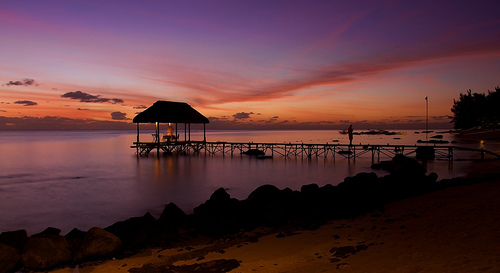
Pictures
Historical Weather
Related Locations
Information of geographic nature is based on public data provided by geonames.org, CIA world facts book, Unesco, DBpedia and wikipedia. Weather is based on NOAA GFS.