-
You are here:
- Homepage »
- United Kingdom »
- England » Clarborough

Clarborough Destination Guide
Discover Clarborough in United Kingdom
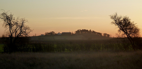
Clarborough in the region of England is a place located in United Kingdom - some 131 mi or ( 211 km ) North of London , the country's capital .
Local time in Clarborough is now 06:35 PM (Tuesday) . The local timezone is named " Europe/London " with a UTC offset of 0 hours. Depending on your mobility, these larger cities might be interesting for you: York, South Wheatley, Sheffield, Normanton on Trent, and Lound. When in this area, you might want to check out York . We discovered some clip posted online . Scroll down to see the most favourite one or select the video collection in the navigation. Are you looking for some initial hints on what might be interesting in Clarborough ? We have collected some references on our attractions page.
Videos
Retford Charter Day 2008 Part 1
Scenes from Retford Charter Day, 5 May 2008. Featuring walkabouts through the funfair in Retford's Market Square, and the charity stalls in Retford's town centre. ..
Retford Railways 1999
Plenty of preserved action through Retford during 1999 especially during the May Day Bank Holiday weekend when some of the remaining legendary Deltic locomotives were back in action. Also included in ..
Retford Railways 1995 (Part One)
Shot around Retford railway station during 1995 this short film includes class 56 and class 58 diesel locomotives, HST and IC225 trains in InterCity Swallow livery. ..
60163 Tornado
60163 Tornado Climbs Gamston bank South bound ..
Videos provided by Youtube are under the copyright of their owners.
Interesting facts about this location
East Retford Rural District
East Retford was a rural district in Nottinghamshire, England from 1894 to 1974. It was formed under the Local Government Act 1894 from East Retford rural sanitary district. It entirely surrounded Retford, which was a municipal borough itself. In 1935 it took in the area of the Misterton Rural District under a County Review Order. The district survived until 1974 when it was abolished under the Local Government Act 1972.
Located at 53.35 -0.92 (Lat./Long.); Less than 1 km away
Retford
Retford (also known as East Retford) is a market town in Nottinghamshire in the East Midlands of England, located 31 miles from the city of Nottingham, and 23 miles west of Lincoln, in the district of Bassetlaw. The town is situated in a valley with the River Idle and the Chesterfield Canal running through the centre of the town. The village of Ordsall is a suburb of the town, divided from Retford by the River Idle and the East Coast Main Line railway.
Located at 53.32 -0.94 (Lat./Long.); Less than 3 km away
Grove, Nottinghamshire
Grove is a small village, lying about 2 miles south-west of Retford, Nottinghamshire. In fact, the parklands of Grove Hall separate it from Retford town, and a set of gates for Grove Hall can be found near the London Road, the A638. The village itself is very pleasant with a village green stretching either side of the main road. The village contains a garden centre housed in the former kitchen gardens, of the Hall and there is also a very fine parish church.
Located at 53.31 -0.89 (Lat./Long.); Less than 4 km away
St. Helen's Church, Grove
St. Helen's Church, Grove is a parish church in the Church of England in Grove, Nottinghamshire. The church is Grade II listed by the Department for Culture, Media & Sport as it is a building of special architectural or historic interest.
Located at 53.31 -0.89 (Lat./Long.); Less than 4 km away
St. Peter's Church, Clayworth
St. Peter's Church, Clayworth is a parish church in the Church of England in Clayworth, Nottinghamshire. The church is Grade I listed by the Department for Culture, Media & Sport as a building of outstanding architectural or historic interest.
Located at 53.39 -0.91 (Lat./Long.); Less than 5 km away
Pictures
Related Locations
Information of geographic nature is based on public data provided by geonames.org, CIA world facts book, Unesco, DBpedia and wikipedia. Weather is based on NOAA GFS.