-
You are here:
- Homepage »
- United Kingdom »
- England » Iwade

Iwade Destination Guide
Explore Iwade in United Kingdom
Iwade in the region of England is a town in United Kingdom - some 38 mi or ( 61 km ) East of London , the country's capital city .
Current time in Iwade is now 04:09 PM (Wednesday) . The local timezone is named " Europe/London " with a UTC offset of 0 hours. Depending on the availability of means of transportation, these more prominent locations might be interesting for you: Tunstall, Shoeburyness, Saint Marys Hoo, Rainham, and Peterborough. Since you are here already, make sure to check out Tunstall . We saw some video on the web . Scroll down to see the most favourite one or select the video collection in the navigation. Where to go and what to see in Iwade ? We have collected some references on our attractions page.
Videos
Punto GT 2L 16VT First Run 3
Punto GT 2L 16VT First Run 3 ..
Halfway Houses ; from top to bottom
A high-speed journey through Halfway Houses, Isle of Sheppey from Telegraph Hill to Sheerness East. ..
queenborough to leysdown under the sheppey bridge 13/09/2009
Trip from Queenborough to Leysdown on sea in darrens boat ..
Halo reach (how it ends- devotchka)
live action halo. awesome. Also, I know the Spartan in first trailer isn't the one in the second, just run with it. ..
Videos provided by Youtube are under the copyright of their owners.
Interesting facts about this location
Kemsley railway station
Kemsley railway station is on the Sheerness Line in north Kent, England, and serves the village of Kemsley. Train services are provided by Southeastern. There are 2 platforms but no station building at this unstaffed location. Access between the two platforms is via the road bridge to the north of the station. A PERTIS self-service ticket machine was provided on the Sittingbourne-bound platform in 2008.
Located at 51.36 0.74 (Lat./Long.); Less than 2 km away
Swale railway station
Swale railway station is in north Kent, England, on the Sheerness Line 4 miles north of Sittingbourne at the southern end of the Kingsferry Bridge which connects the Isle of Sheppey to mainland Kent. The nearest settlement is Iwade. Train services are provided by Southeastern.
Located at 51.39 0.75 (Lat./Long.); Less than 2 km away
Sittingbourne and Kemsley Light Railway
The Sittingbourne & Kemsley Light Railway in Kent is a 30 gauge heritage railway that operates from Sittingbourne to the banks of The Swale. The line was formerly owned by Bowater, the paper making firm, and was used to carry raw materials and finished products between Ridham Dock and the company's two mills, one at Sittingbourne and the other at Kemsley.
Located at 51.36 0.75 (Lat./Long.); Less than 3 km away
Sittingbourne and Milton Urban District
Sittingbourne and Milton was an urban district in Kent, England, consisting of the settlements of Sittingbourne and Milton Regis. It was abolished in 1974 under the Local Government Act 1972, and made part of the Swale district.
Located at 51.35 0.73 (Lat./Long.); Less than 3 km away
Queenborough-in-Sheppey
Queenborough-in-Sheppey was a municipal borough in Kent, England from 1968 to 1974. It was created by a merger of the Municipal Borough of Queenborough with Sheerness Urban District and Sheppey Rural District, and occupied the entire Isle of Sheppey.
Located at 51.41 0.74 (Lat./Long.); Less than 4 km away
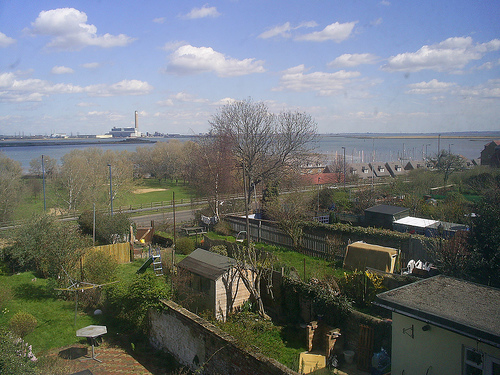
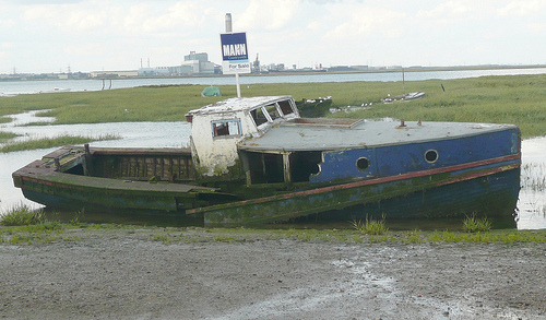
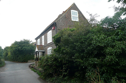
Pictures
Historical Weather
Related Locations
Information of geographic nature is based on public data provided by geonames.org, CIA world facts book, Unesco, DBpedia and wikipedia. Weather is based on NOAA GFS.