-
You are here:
- Homepage »
- United Kingdom »
- England » Tideswell

Tideswell Destination Guide
Discover Tideswell in United Kingdom
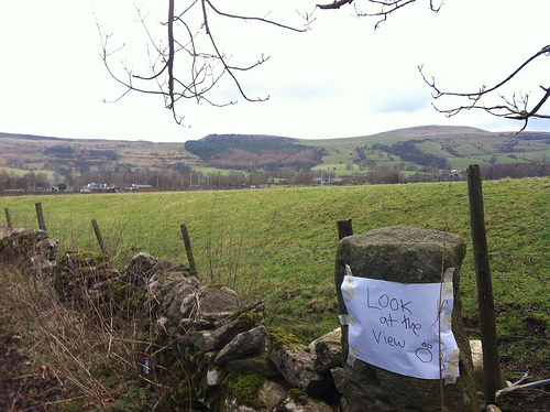
Tideswell in the region of England with its 1,719 habitants is a town located in United Kingdom - some 141 mi or ( 226 km ) North-West of London , the country's capital .
Local time in Tideswell is now 08:19 PM (Wednesday) . The local timezone is named " Europe/London " with a UTC offset of 0 hours. Depending on your flexibility, these larger cities might be interesting for you: Warslow, Upper Elkstone, Ughill, Stony Middleton, and Sheffield. When in this area, you might want to check out Warslow . We found some clip posted online . Scroll down to see the most favourite one or select the video collection in the navigation. Are you looking for some initial hints on what might be interesting in Tideswell ? We have collected some references on our attractions page.
Videos
Reggae Dubstep
Song is 'Dreadlok' by 'OSC' // Recorded From dubstep.fm. Reggae-Dubstep Reggae Dubstep ..
Mattafix - Big City Life (upbeat remix)
Amazing song. old but the words are so amazing i had to put it on you tube. Gutted to see that this song wasnt on here. Hope you like as much as me. ..
Beerfight & Manchester City´s Tevez song
New New Lyrics: You'll never play for man city again, again You´ll never shag a sexy bird, tevez, tevez. You´ll never shag a sexy bird, tevez, tevez. You argie twat, you are a cunt, you´ve sown your h ..
Rhydian Roberts World In Union (None motion video)
This is Rhydian singing World In Union. I thought this was a great song, Maybe his best but i couldn't find it on here so here it is :) ..
Videos provided by Youtube are under the copyright of their owners.
Interesting facts about this location
Millers Dale
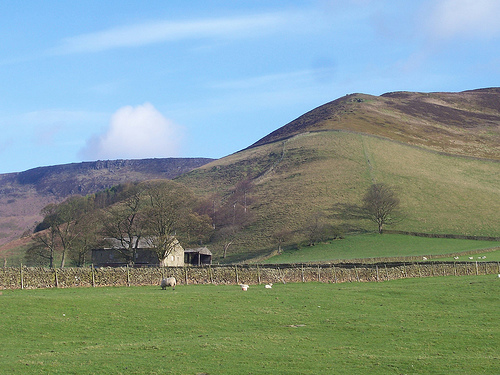
Millers Dale is a valley on the River Wye in Derbyshire. It is a popular beauty spot in the Peak District of England, much of the area being preserved as a Site of Special Scientific Interest. Nearby is Ravenstor and Cheedale, both popular with rock-climbers. Just to the north of the Dale lies the village of Wormhill and the lesser known valleys of Peter Dale and Monk's Dale, the latter being listed as a Site of Special Scientific Interest and a nature reserve.
Located at 53.25 -1.76 (Lat./Long.); Less than 3 km away
Monsal Dale
Monsal Dale is a valley in the Peak District of Derbyshire in England. In geological history this area of Derbyshire was long ago under water, and is formed from a subsequent uplift of resultant sedimentary deposits, known as the Derbyshire Dome. Overlying sandstones and shales have been eroded away, exposing the underlying limestone which forms the basis of the area today, which is consequently known as the White Peak.
Located at 53.24 -1.73 (Lat./Long.); Less than 5 km away
Blackwell Mill
Blackwell Mill is a location in Derbyshire, near to the village of Blackwell near Buxton, but not part of it. There was once a corn mill on the River Wye which may have dated from 1066. Most of it has disappeared, apart from the weir. What is left is marked as an Ancient Monument. It stands at the meeting point of several valleys: Great Rocks Dale, Chee Dale and Ashford Dale. In times past the Manchester Turnpike forded the river.
Located at 53.25 -1.83 (Lat./Long.); Less than 5 km away
Calton Hill, Derbyshire
Calton Hill is a Site of Special Scientific Interest in Derbyshire, England, showing Olivine Diorite magma chamber. It is the site of an extinct volcano and the quarrying that has now been abandoned means that it is possible to observe the geological structures caused by the repeated eruptions. The eruptions were small and were then underwater as Derbyshire was covered by a sea in the Carboniferous period (around 330 million years ago).
Located at 53.24 -1.82 (Lat./Long.); Less than 5 km away
Cave Dale
Cave Dale (sometimes spelt Cavedale) is a dry limestone valley in the Derbyshire Peak District, England. It is located at grid reference SK149824. The northern end of the dale starts at the village of Castleton where the valley sides are almost perpendicular and over 50 metres in height. The dale rises gently after leaving Castleton for approximately 200 metres before becoming steeper culminating in a fine viewpoint down the dale taking in Peveril Castle with Lose Hill behind (see picture).
Located at 53.34 -1.78 (Lat./Long.); Less than 7 km away
Pictures

Related Locations
Information of geographic nature is based on public data provided by geonames.org, CIA world facts book, Unesco, DBpedia and wikipedia. Weather is based on NOAA GFS.