-
You are here:
- Homepage »
- United Kingdom »
- Wales » Llangynog

Llangynog Destination Guide
Explore Llangynog in United Kingdom
Llangynog in the region of Wales is a place in United Kingdom - some 166 mi or ( 267 km ) North-West of London , the country's capital city .
Time in Llangynog is now 03:53 AM (Thursday) . The local timezone is named " Europe/London " with a UTC offset of 0 hours. Depending on your budget, these more prominent locations might be interesting for you: Wolverhampton, Swansea, Sheffield, Pale, and Manchester. Since you are here already, consider visiting Wolverhampton . We saw some hobby film on the internet . Scroll down to see the most favourite one or select the video collection in the navigation. Where to go and what to see in Llangynog ? We have collected some references on our attractions page.
Videos
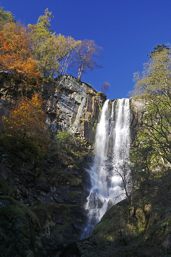
The Tallest Waterfall in Wales
We took a trip to Pistyll Rhaeadr, Wales's highest waterfall. But where exactly is it? And is that a mermaid in the pool beneath? Questions, questions... ..
Foel Ortho Walkthrough
Video showing the majesty of the Farmhouse and garden. I missed off the moat with guard-fish unfortunately. ..
Videos provided by Youtube are under the copyright of their owners.
Interesting facts about this location
Llangynog
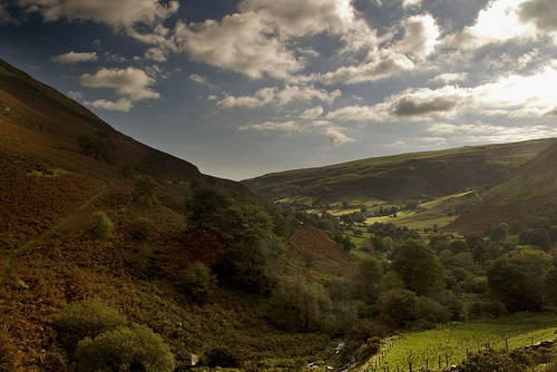
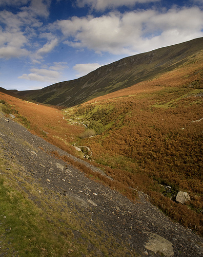
Llangynog Powys lies at the confluence of the Afon Eirth and the Afon Tanat at the foot of the Berwyn range in Powys, Wales. Pop c.300 It lies at the foot of the Milltir Cerrig mountain pass on the B4391 road, which runs between Llan Ffestiniog and Llanfyllin (though the B4391 road number 'disappears' between the western end of Llyn Celyn and Bala). It is surrounded by mountains and is a popular base for walkers.
Located at 52.83 -3.41 (Lat./Long.); Less than 1 km away
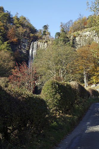
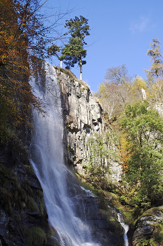
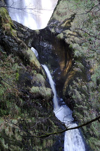
Pistyll Rhaeadr
Pistyll Rhaeadr (meaning "spring of the waterfall") is a waterfall, located a few miles from the village of Llanrhaeadr-ym-Mochnant in Powys, Wales, twelve miles west of Oswestry.
Located at 52.85 -3.38 (Lat./Long.); Less than 3 km away
Cyrniau Nod
Cyrniau Nod is a mountain summit in north east Wales. It is the smaller of the two Marilyns that form the Berwyn range, the other being Cadair Berwyn. Its summit has the Snowdonia National Park boundary running through it. A number of rivers and streams rise from near the mountain including Afon Tanat, Afon Cedig and Nant Ystrad-y-Groes. The views from the summit are extensive, if unremarkable due to the featureless, flat moorland surroundings.
Located at 52.88 -3.39 (Lat./Long.); Less than 5 km away
Milltir Cerrig
The Milltir Cerrig (Welsh for "Mile of Stones") is a mountain pass in Wales, on the B4391 between Bala (in the county of Gwynedd) and Llangynog, briefly passing through Denbighshire. It crosses the Berwyn mountain range at an altitude of 486 metres (1594 feet). From the summit of the pass, a bridleway heads east across the main Berwyn summits; Moel Sych, Cadair Berwyn and Cadair Bronwen. These three peaks can be seen on the climb from Bala.
Located at 52.86 -3.46 (Lat./Long.); Less than 5 km away
Moel Sych
Moel Sych is a subsidiary summit of Cadair Berwyn in north east Wales. It is jointly the second highest summit in the Berwyn range along with Cadair Berwyn North Top. The summit was often considered to be the highest summit in the Berwyns until Cadair Berwyn North Top, then known as Cadair Berwyn was found to be of the same height. Later on the OS discovered a new top in between the two, which was 3m higher at 830m.
Located at 52.88 -3.38 (Lat./Long.); Less than 5 km away
Pictures
Related Locations
Information of geographic nature is based on public data provided by geonames.org, CIA world facts book, Unesco, DBpedia and wikipedia. Weather is based on NOAA GFS.